Viewpoints · Undated
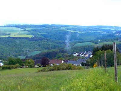
Aussichtspunkt Schell


Description
This description is only available in German.
Translate with Google opens this page in Google Translate (external service)
Classification
- Subject area
- Natural Features
- Category
- Viewpoints
- Date
- Undatiert
- Period
- Undated
Location
- District
- Trier-Saarburg
- Collective municipality
- Ruwer
- Municipality
- Korlingen
- Field name
- Auf dem Schell
- Coordinates
- WGS 84: 49.736231, 6.722635 (Position: exact) WGS 84: 49° 44′ 10.4″ N, 6° 43′ 21.5″ E UTM 32 (ETRS89): E 335904 · N 5511793
Sources
Data sources
- [1] Landschaftsplan zum Flächennutzungsplander Verbandsgemeinde Ruwer, 2015. Fischer & BHM Planungsgesellschaft mbH i.G. https://www.ruwer.de/cams/core/cams_file.php?mod=b%FCrger_dateien&i…
- [2] Michael Grün, Trier, 2020.
On the internet
Picture credits
Last edited: 8 Oct 2020 Object ID: 48877
https://kulturdb.de/en/objekt/48877-korlingen-aussichtspunkt-schell
Nearby
The nearest objects
No picture
400 m
Field Names
Beim Breitenborn
No picture
500 m
Vineyard Sites
Langanwand ober dem Wingert
 620 m
Vineyard Sites
Ober dem Wingert am Weg
No picture
650 m
Vineyard Sites
Hinter dem Wingert
No picture
660 m
Extraction and Processing of Raw Materials
Ehemaliger Schieferbruch
No picture
690 m
Vineyard Sites
Ober dem Wingert
No picture
700 m
Field Names
Beim Fundelborn
No picture
780 m
Vineyard Sites