Viewpoints · 21st Century
Aussichtspunkt Gipfelkreuz am Ringelstein


© GeoBasis-DE / LVermGeoRP, dl-de/by-2-0
There is no picture of this object yet. Do you have a photo that you would like to make available to the Kulturdatenbank? Submit a picture
Description
This description is only available in German.
Translate with Google opens this page in Google Translate (external service)
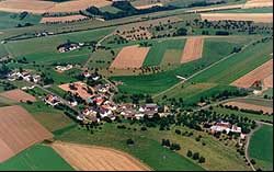
Und die Aussicht kann sich sehen lassen. Ohne Hindernisse breiten sich vor dem Gipfelkreuz das Bitburger Land und die Südeifel aus: Biersdorf direkt zu Füßen und die Stadt des Bieres in relativer Ferne. An besonders klaren Tagen soll sogar der Erbeskopf am Horizont zu erkennen sein. [1]
Classification
- Subject area
- Natural Features
- Category
- Viewpoints
- Date
- 2005
- Period
- 21st Century
Location
- District
- Eifelkreis Bitburg-Prüm
- Collective municipality
- Bitburger Land
- Municipality
- Niederweiler
- Field name
- Ringelstein
- Coordinates
- WGS 84: 50.023244, 6.441935 (Position: exact) WGS 84: 50° 01′ 23.7″ N, 6° 26′ 31.0″ E UTM 32 (ETRS89): E 316770 · N 5544350
Sources
Data sources
- [1] Frank Auffenberg https://www.volksfreund.de/region/bitburg-pruem/gipfelkreuz-und-gip…
On the internet
Last edited: 4 Jun 2020 Object ID: 49494
https://kulturdb.de/en/objekt/49494-niederweiler-aussichtspunkt-gipfelkreuz-am-ringelstein
Nearby
The nearest objects
Wayside Shrines and Stations of the Cross
Gipfelkreuz am Ringelstein
Viewpoints
Aussichtspunkt Ringelstein
Burial Mounds
Grabhügelgruppe
Field Names
Meiersbach
Field Names
Ober Meiersbach
Field Names
Im Rothenberg
 610 m
Settlements
Römische Fundstelle
Farmhouses and Farm Buildings