Wayside Shrines and Stations of the Cross · Renaissance
Wegekreuz


Description
This description is only available in German.
Translate with Google opens this page in Google Translate (external service)
Schaftkreuz aus Rotsandstein, umgesetzt, Setzungs- bzw. Entstehungszeit ca. 1530. [1]
Classification
- Subject area
- Architectural and Art Monuments
- Category
- Religious Buildings
- Object type
- Wayside Shrines and Stations of the Cross
- Date
- ca. 1530
- Period
- Renaissance
Location
- District
- Trier-Saarburg
- Collective municipality
- Trier-Land
- Municipality
- Welschbillig
- Locality / location
- Ittel
- Street
- Ecke Oberstraße / Hohlbach
- Field name
- Ortslage
- Coordinates
- WGS 84: 49.869229, 6.589026 (Position: exact) WGS 84: 49° 52′ 09.2″ N, 6° 35′ 20.5″ E UTM 32 (ETRS89): E 326753 · N 5526879
Sources
Data sources
- [1] Ferring, Stefan: Die Wegekreuze der Verbandsgemeinde Trier-Land. Examensarbeit von 1998.
On the internet
Picture credits
Last edited: 26 Aug 2020 Object ID: 49676
https://kulturdb.de/en/objekt/49676-welschbillig-wegekreuz
Nearby
The nearest objects
Farmhouses and Farm Buildings
Streckhof
Fountains and Wells
Brunnenstube
Farmhouses and Farm Buildings
Streckhof
Fountains and Wells
Brunnenanlage
Find Sites
Einzelfund eines römischen Schwertes
Farmhouses and Farm Buildings
Zweiseithof
 270 m
War Memorials
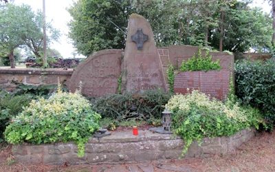
Kriegerdenkmal beider Weltkriege
 270 m
Catholic Churches