Field Names · Undated
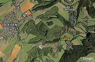
Aufm Laarberg beim Kreuz


© GeoBasis-DE / LVermGeoRP, dl-de/by-2-0
There is no picture of this object yet. Do you have a photo that you would like to make available to the Kulturdatenbank? Submit a picture
Description
This description is only available in German.
Translate with Google opens this page in Google Translate (external service)
Lar (Lahr, Laar, Laer, Lohr, Loir) – Bedeutung: Weideplatz (wilde Weide), Grasplatz. Die Bedeutung des Namens ist in der Namenforschung heftig umstritten. [1]
Classification
- Subject area
- History
- Category
- Field Names
- Date
- Undatiert
- Period
- Undated
Location
- District
- Eifelkreis Bitburg-Prüm
- Collective municipality
- Arzfeld
- Municipality
- Daleiden
- Field name
- Aufm Laarberg beim Kreuz
- Coordinates
- WGS 84: 50.072822, 6.196979 (Position: exact) WGS 84: 50° 04′ 22.2″ N, 6° 11′ 49.1″ E UTM 32 (ETRS89): E 299433 · N 5550491
Sources
Data sources
- [1] Dittmaier, Heinrich: Rheinische Flurnamen. Ludwig Röhrscheid Verlag, Bonn, 1963.
On the internet
Last edited: 2 Nov 2020 Object ID: 50155
https://kulturdb.de/en/objekt/50155-daleiden-aufm-laarberg-beim-kreuz
Nearby
The nearest objects
Field Names
Am Laarberg
Field Names
Am Laarberg
Field Names
Rückersdell
Field Names
Unter dem Scheid
Field Names
Hinter dem Scheid
Deserted Settlements
Weiler Laarberg
Field Names
Rettendell
 770 m
Natural Landscapes