Field Names · Undated
Im Neuen Anspann


© GeoBasis-DE / LVermGeoRP, dl-de/by-2-0
There is no picture of this object yet. Do you have a photo that you would like to make available to the Kulturdatenbank? Submit a picture
Description
This description is only available in German.
Translate with Google opens this page in Google Translate (external service)
Anspann – Bedeutung: [...] Anspann haftet an Steillagen und Steilwegen und ist wohl zum Zeitwort anspannen zu stellen; er bezeichnet als offenbar einen Platz, an dem zur Überwindung der Steigung Zugtiere vor oder beigespannt werden mußten bzw. müssen. [1]
Classification
- Subject area
- History
- Category
- Field Names
- Date
- Undatiert
- Period
- Undated
Location
- District
- Bernkastel-Wittlich
- Collective municipality
- Einheitsgemeinde Morbach
- Municipality
- Morbach
- Locality / location
- Gonzerath
- Field name
- Im Neuen Anspann
- Coordinates
- WGS 84: 49.849028, 7.122724 (Position: exact) WGS 84: 49° 50′ 56.5″ N, 7° 07′ 21.8″ E UTM 32 (ETRS89): E 365044 · N 5523535
Sources
Data sources
- [1] Dittmaier, Heinrich: Rheinische Flurnamen. Ludwig Röhrscheid Verlag, Bonn, 1963.
On the internet
Last edited: 22 Jan 2023 Object ID: 52160
https://kulturdb.de/en/objekt/52160-morbach-im-neuen-anspann
Nearby
The nearest objects
 150 m
Road Transport
Spuren einer Römerstraße
 150 m
Burial Mounds
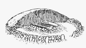
Hügelgräber
Extraction and Processing of Raw Materials
Ehemaliger Steinbruch am Hundheimer Bach
Wayside Shrines and Stations of the Cross
Wegekreuz
Extraction and Processing of Raw Materials
Ehemaliger Steinbruch
Field Names
Auf Scheitelrech
Field Names
In der Trift
Chapels