Flood Marks · 20th Century
Hochwassermarken am Pegelhaus


Description
This description is only available in German.
Translate with Google opens this page in Google Translate (external service)
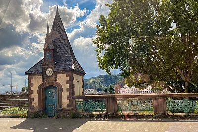
Am alten Pegelhaus am Johanniterufer sind an der Aussenwand zur Moselseite hin 2 Hochwassermarken angebracht:
HOCHWASSER DEZ. 1993
HOCHWASSER MAI 1983 [1]
[Nähere Informationen zum Pegelhaus s. Objekt Id 5320]
Classification
- Subject area
- Architectural and Art Monuments
- Category
- Markers and Monuments
- Object type
- Flood Marks
- Date
- Nach 1918
- Period
- 20th Century
Location
- District
- City of Trier
- Collective municipality
- Verbandsfreie Gemeinde Trier
- Town
- Trier
- Locality / location
- Mitte-Gartenfeld
- Street
- Johanniterufer
- Field name
- Ortslage
- Coordinates
- WGS 84: 49.752300, 6.628070 (Position: exact) WGS 84: 49° 45′ 08.3″ N, 6° 37′ 41.1″ E UTM 32 (ETRS89): E 329147 · N 5513791
Sources
Data sources
- [1] Michael Grün, Trier, 2023.
On the internet
de.wikipedia.org/wiki/Trier-Mitte/Gartenfeld
Picture credits
Last edited: 9 Oct 2023 Object ID: 52822
https://kulturdb.de/en/objekt/52822-trier-hochwassermarken-am-pegelhaus
Nearby
The nearest objects
 less than 10 m
Shipping
Pegelhaus
 20 m
Town Fortifications
Ehemaliger Turm hinter Sankt Niklas
30 m
Town Fortifications
Ehem. Turm der mittelalterl. Stadtmauer - Nr. 48
 50 m
Surveying
Höhenfestpunkt an Römerbrücke
 60 m
Town Fortifications
Ehemaliges Brückentor
60 m
Town Fortifications
Ehemaliger Sankt-Niklas-Turm
 70 m
Administrative Buildings
Ehemaliges Zolltor
Street Names