Extraction and Processing of Raw Materials · Gothic
Eisenerz-Tagebau
Wüstung

Description
This description is only available in German.
Translate with Google opens this page in Google Translate (external service)
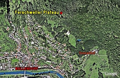
In diesem Gebiet wurde im ganzen Mittelalter durch das sehr begehrte Brauneisenstein obertägig abgebaut.
Classification
- Subject area
- Archaeological Monuments
- Category
- Economy, Trade and Transport
- Object type
- Extraction and Processing of Raw Materials
- Date
- Circa 1100 bis circa 1500
- Period
- Gothic
Location
- District
- Eifelkreis Bitburg-Prüm
- Collective municipality
- Südeifel
- Municipality
- Bollendorf
- Field name
- Ortslage
- Coordinates
- WGS 84: 49.856417, 6.360968 (Position: presumed) WGS 84: 49° 51′ 23.1″ N, 6° 21′ 39.5″ E UTM 32 (ETRS89): E 310317 · N 5526007
Sources
Data sources
- Janssen, W.: Studien zur Wüstungsfrage im fränkischen Altsiedelland zwischen Rhein, Mosel und Eifelnordrand. 2 Bände. Text u. Katalog, 1975.
On the internet
Picture credits
- Picture 1: Internet
Last edited: 7 Oct 2003 Object ID: 569
https://kulturdb.de/en/objekt/569-bollendorf-eisenerz-tagebau
Nearby
The nearest objects
No picture
60 m
Fortresses and Bunkers
Westwall - Schartenstand
No picture
190 m
Fortresses and Bunkers
Westwall - Schartenstand
No picture
240 m
Field Names
Im Dell
No picture
260 m
Chapels
Kapelle
 270 m
Natural Fortresses
Ferschweiler Plateau - Ossenlei
No picture
270 m
Rocks
Ossenlay
No picture
290 m
Fortresses and Bunkers
Westwall - Schartenstand
No picture
370 m
Cottage Gardens