Farmhouses and Farm Buildings · Historicism / Art Nouveau
Weingut
- Listed monument


© GeoBasis-DE / LVermGeoRP, dl-de/by-2-0
There is no picture of this object yet. Do you have a photo that you would like to make available to the Kulturdatenbank? Submit a picture
Description
This description is only available in German.
Translate with Google opens this page in Google Translate (external service)
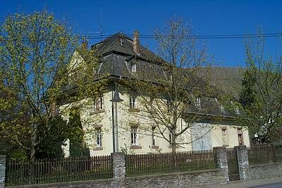
Weingut, neubarocke Mansardwalmdach-Villa und -Kelterhaus, um 1910. [1]
Classification
- Subject area
- Architectural and Art Monuments
- Category
- Residential and Farm Buildings
- Object type
- Farmhouses and Farm Buildings
- Date
- Um 1910
Location
- District
- Trier-Saarburg
- Collective municipality
- Ruwer
- Municipality
- Kasel
- Street
- Hauptstrasse 1
- Field name
- Ortslage
- Coordinates
- WGS 84: 49.762842, 6.727542 (Position: exact) WGS 84: 49° 45′ 46.2″ N, 6° 43′ 39.2″ E UTM 32 (ETRS89): E 336347 · N 5514741
Sources
Data sources
- [1] Denkmaltopographie Bundesrepublik Deutschland. Kulturdenkmäler in Rheinland-Pfalz. Band 12.2 Kreis Trier-Saarburg. Wernersche Verlagsgesellschaft mbH, Worms. ISBN 3-88462-110-6 (1. Auflage 1994)
On the internet
Last edited: 29 Jul 2026 Object ID: 57706
https://kulturdb.de/en/objekt/57706-kasel-weingut
Nearby
The nearest objects
Fortresses and Bunkers
Westwall - Bunker
 60 m
Farmhouses and Farm Buildings
Weingut
Fortresses and Bunkers
Westwall - Maschinengewehr-Schartenstand
 100 m
Farmhouses and Farm Buildings
Ehemaliges Hofgut
Farmhouses and Farm Buildings
Ehemaliges Hofgut
Farmhouses and Farm Buildings
Keltergebäude von Nell
 130 m
Farmhouses and Farm Buildings
Keltergebäude
Field Names