Natural Fortresses · Prehistory / Early History
Ferschweiler Plateau
Abschnitt 30a


© GeoBasis-DE / LVermGeoRP, dl-de/by-2-0
There is no picture of this object yet. Do you have a photo that you would like to make available to the Kulturdatenbank? Submit a picture
Description
This description is only available in German.
Translate with Google opens this page in Google Translate (external service)
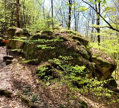
650 Meter westlich Fraubillenkreuz. Durch hohe steile Felswände existiert ein natürlicher Schutz. Zwei Steinbrüche (I und II) durchbrechen den oberen Plateaurand. Aus Steinbruch I stammen das bronzezeitliche Schwert und die Lanzenspitze. Beide Gegenstände werden im Museum Luxemburg aufbewahrt. Peter Weber aus Holsthum fand hier viele urnenfelderzeitliche Scherben, die er 1980 dem Museum Trier übergab. [1]
Classification
- Subject area
- Archaeological Monuments
- Object type
- Natural Fortresses
- Date
- Circa 750 vor Chr. bis circa 450 vor Chr.
Location
- District
- Eifelkreis Bitburg-Prüm
- Collective municipality
- Südeifel
- Municipality
- Nusbaum
- Field name
- Im Glaubersborn
- Coordinates
- WGS 84: 49.872455, 6.361463 (Position: exact) WGS 84: 49° 52′ 20.8″ N, 6° 21′ 41.3″ E UTM 32 (ETRS89): E 310415 · N 5527789
Sources
Data sources
- [1] Vor- und frühgeschichtliche Burgwälle des Regierungsbezirkes Trier und des Kreises Birkenfeld. Von Karl-Heinz Koch und Reinhard Schindler. Selbstverlag des Rheinischen Landesmuseums Trier 1994. Online-Shop: www.landesmuseum-trier-shop.de
On the internet
Last edited: 7 Oct 2003 Object ID: 7346
https://kulturdb.de/en/objekt/7346-nusbaum-ferschweiler-plateau
Nearby
The nearest objects
Extraction and Processing of Raw Materials
Ehemaliger Steinbruch
Field Names
Im Glaubersborn
Extraction and Processing of Raw Materials
Ehemaliger Steinbruch
Field Names
In der Schinddell
 370 m
Works of Art
Stein der Wahrheit
 380 m
Natural Fortresses
Ferschweiler Plateau
Extraction and Processing of Raw Materials
Ehemaliger Steinbruch
 450 m
Natural Fortresses