Mills · Renaissance
Hüstersmühle
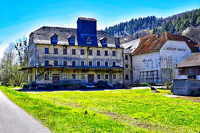
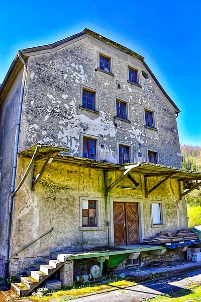


Description
This description is only available in German.
Translate with Google opens this page in Google Translate (external service)
Frühere Bezeichnungen: Kalzendonier/ Catzendonier/Ley Mühle. Erste Erwähnung 1633 in Maximiner Abrechnungen. [1]
Classification
- Subject area
- Architectural and Art Monuments
- Object type
- Mills
- Date
- 1633
- Period
- Renaissance
Location
- District
- City of Trier
- Collective municipality
- Verbandsfreie Gemeinde Trier
- Town
- Trier
- Locality / location
- Ruwer/Eitelsbach
- Street
- Fischweg 30
- Field name
- Bei der Laymühle
- Coordinates
- WGS 84: 49.778899, 6.713511 (Position: exact) WGS 84: 49° 46′ 44.0″ N, 6° 42′ 48.6″ E UTM 32 (ETRS89): E 335391 · N 5516557
Sources
Data sources
- [1] Jutta Schömer-Steinbach, Ruwer, 2018.
On the internet
Picture credits
Last edited: 10 Apr 2026 Object ID: 7566
https://kulturdb.de/en/objekt/7566-trier-huestersmuehle
Nearby
The nearest objects
No picture
70 m
Vineyard Sites
Maximiner
 110 m
Fortresses and Bunkers
Felsenhöhle als Bunker
No picture
180 m
Vineyard Sites
Maximiner
No picture
220 m
Field Names
Auf der Frohnwiese
 230 m
Mills
Ehemalige Lambertys Mühle
No picture
230 m
Place Names / Local History
Ortsgeschichte Ruwer-Eitelsbach
No picture
370 m
Mills
Ehemalige Born- oder Nonnen-Mühle
No picture
370 m
Field Names