Mills · Neoclassicism
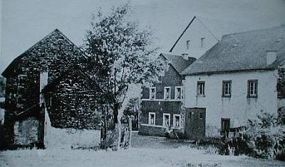
Oberscheidweiler Mühle


© GeoBasis-DE / LVermGeoRP, dl-de/by-2-0
There is no picture of this object yet. Do you have a photo that you would like to make available to the Kulturdatenbank? Submit a picture
Description
This description is only available in German.
Translate with Google opens this page in Google Translate (external service)
Mahl- Öl- und Walkmühle an der Alf. Erbaut 1782. Mahlbetrieb bis Juli 1972. Ab 1975 Reithof, Restaurant, Pemsion.
Classification
- Subject area
- Architectural and Art Monuments
- Object type
- Mills
- Date
- 1782
- Period
- Neoclassicism
Location
- District
- Bernkastel-Wittlich
- Collective municipality
- Wittlich-Land
- Municipality
- Oberscheidweiler
- Locality / location
- Oberscheidweilermühle
- Field name
- Mühlenberg
- Coordinates
- WGS 84: 50.083702, 6.949105 (Position: exact) WGS 84: 50° 05′ 01.3″ N, 6° 56′ 56.8″ E UTM 32 (ETRS89): E 353279 · N 5549952
Sources
Data sources
- Günter Hesse und Wolfgang Schmitt-Kölzer: Manderscheid. Hrsg.: Verbandsgemeinde Manderscheid 1986.
On the internet
Last edited: 1 Nov 2008 Object ID: 7750
https://kulturdb.de/en/objekt/7750-oberscheidweilermuehle-oberscheidweiler-muehle
Nearby
The nearest objects
Mills
Springiersbacher Mühle
Field Names
In den Vierteln unter der Gemeindewies
Field Names
Aufm Süßenrech
Field Names
In der Krummwies
Field Names
Breitwies
Wayside Shrines and Stations of the Cross
Wegekreuz
 910 m
Mills
Sprinker Mühle im Alftal
Wayside Shrines and Stations of the Cross