Pilgrimage Routes · Undated
Alter Pilgerweg nach Klausen


© GeoBasis-DE / LVermGeoRP, dl-de/by-2-0
There is no picture of this object yet. Do you have a photo that you would like to make available to the Kulturdatenbank? Submit a picture
Classification
- Subject area
- Architectural and Art Monuments
- Category
- Markers and Monuments
- Object type
- Pilgrimage Routes
- Date
- Undatiert
- Period
- Undated
Location
- District
- Bernkastel-Wittlich
- Collective municipality
- Wittlich-Land
- Municipality
- Osann-Monzel
- Locality / location
- Monzel
- Field name
- Im Feberchen
- Coordinates
- WGS 84: 49.910054, 6.903311 (Position: exact) WGS 84: 49° 54′ 36.2″ N, 6° 54′ 11.9″ E UTM 32 (ETRS89): E 349462 · N 5530738
Sources
Data sources
- [1] Eifelverein. Wanderkarte 1:25.000 Nr. 24 "Wittlicher Land"
On the internet
Last edited: 26 May 2010 Object ID: 7957
https://kulturdb.de/en/objekt/7957-osann-monzel-alter-pilgerweg-nach-klausen
Nearby
The nearest objects
No picture
60 m
Find Sites
Fundstreuung römischer Ziegel
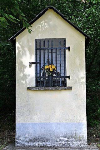 150 m
Wayside Shrine Houses
Marien-Bildstock
No picture
240 m
Field Names
Hungerscheune
No picture
460 m
Field Names
Unterm Aulenbüsch
No picture
510 m
Extraction and Processing of Raw Materials
Ehemaliger Steinbruch
 540 m
Settlements
Römische Siedlungsstelle
No picture
780 m
Field Names
In der Maarwies
No picture
780 m
Fossils