Christian Cemeteries · Undated
Friedhof Bombogen


© GeoBasis-DE / LVermGeoRP, dl-de/by-2-0
There is no picture of this object yet. Do you have a photo that you would like to make available to the Kulturdatenbank? Submit a picture
Description
This description is only available in German.
Translate with Google opens this page in Google Translate (external service)
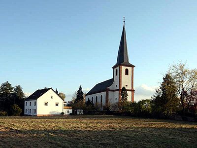
Der Friedhof umgibt die im Wittlicher Tal weithin sichtbare Pfarrkirche Mariä Himmelfahrt an der Alberostraße. Auf einer Fläche von 0,65 Hektar sind etwa 500 Grabstätten vorhanden. Eine Zufahrtsmöglichkeit mit Parkplätzen besteht über die Straße An der Neuwiese.
Classification
- Subject area
- Natural Features
- Category
- Parks, Gardens and Cemeteries
- Object type
- Christian Cemeteries
- Date
- Undatiert
- Period
- Undated
Location
- District
- Bernkastel-Wittlich
- Collective municipality
- Verbandsfreie Gemeinde Wittlich
- Town
- Wittlich
- Locality / location
- Bombogen
- Street
- An der Neuwiese
- Field name
- Ortslage
- Coordinates
- WGS 84: 49.988464, 6.938122 (Position: exact) WGS 84: 49° 59′ 18.5″ N, 6° 56′ 17.2″ E UTM 32 (ETRS89): E 352201 · N 5539385
Sources
Data sources
- Homepage der Stadtwerke Wittlich, 2004. http://www.stadtwerke.wittlich.de/service/default.htm
On the internet
Last edited: 26 Apr 2004 Object ID: 8344
https://kulturdb.de/en/objekt/8344-wittlich-friedhof-bombogen
Nearby
The nearest objects
Wayside Shrines and Stations of the Cross
Wegekreuz
 60 m
Catholic Churches
Pfarrkirche Mariä Himmelfahrt
Place Names / Local History
Erste Erwähnung als Bumaga
 80 m
Wayside Shrines and Stations of the Cross
Bildstock
 100 m
War Memorials
Kriegerdenkmal
Farmhouses and Farm Buildings
Gebäudegruppe
Schools
Ehemalige katholische Schule
Field Names