Farmhouses and Farm Buildings · Neoclassicism
Gehöft
- Listed monument


© GeoBasis-DE / LVermGeoRP, dl-de/by-2-0
There is no picture of this object yet. Do you have a photo that you would like to make available to the Kulturdatenbank? Submit a picture
Description
This description is only available in German.
Translate with Google opens this page in Google Translate (external service)
Den nördlichen Dorfeingang nimmt ein Gehöft aus drei freistehenden Gebäuden ein. Hinter dem leicht abfallenden Hof präsentiert sich das großvolumige Wohnhaus übereck zur Einfahrt zwischen den beiden jeweils entlang eines Arms der Straßengabelung ausgerichteten Wirtschaftsgebäuden. Eine Platte im Giebel trägt die Jahreszahl 1787.
[...]
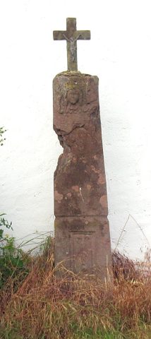
Der langgestreckte südliche Wirtschaftstrakt ist auf dem Keilstein des hofseitigen Scheunentores 1811 datiert. Der Wegekreuzschaft aus gelbem Sandstein vor dem Giebel des Ökonomiegebäudes trägt die nur fragmentarisch erhaltene Inschrift[...](Kaschen)BACH HAT ZU EHREN GOTTES DIESES KREUZ (lassen er)RICHTEN. [1]
Classification
- Subject area
- Architectural and Art Monuments
- Category
- Residential and Farm Buildings
- Object type
- Farmhouses and Farm Buildings
- Date
- 1787
- Period
- Neoclassicism
Location
- District
- Eifelkreis Bitburg-Prüm
- Collective municipality
- Südeifel
- Municipality
- Kaschenbach
- Street
- Haus Nr. 1
- Field name
- Ortslage
- Coordinates
- WGS 84: 49.876581, 6.480361 (Position: exact) WGS 84: 49° 52′ 35.7″ N, 6° 28′ 49.3″ E UTM 32 (ETRS89): E 318973 · N 5527953
Sources
Data sources
- [1] Denkmaltopographie Bundesrepublik Deutschland, Kulturdenkmäler in Rheinland-Pfalz, Kreis Bitburg-Prüm, 9.2 Wernersche Verlagsgesellschaft 1994. ISBN 3-88462-132-7
On the internet
Last edited: 24 May 2004 Object ID: 8416
https://kulturdb.de/en/objekt/8416-kaschenbach-gehoeft
Nearby
The nearest objects
Wayside Shrines and Stations of the Cross
Wegekreuzschaft
Farmhouses and Farm Buildings
Gehöft
 50 m
Catholic Churches
Sankt Michael
Farmhouses and Farm Buildings
Spätbarockes Haus
 60 m
Nativity Scenes
Sankt Michael - Weihnachtskrippe
 60 m
Place Names / Local History
Chronik der Gemeinde Kaschenbach
 60 m
Coats of Arms
Wappen der Gemeinde Kaschenbach
 60 m
Wayside Shrines and Stations of the Cross