Place Names / Local History · Gothic
Ortsgeschichte Hütterscheid

Description
This description is only available in German.
Translate with Google opens this page in Google Translate (external service)
1244 wird ein Henricus de Houckesheide in einer Urkunde erwähnt, 1463 Huderscheit. Hütterscheid gehört bis nach der französischen Revolution zur luxemburgischen Herrschaft Neuerburg, Quartier Vianden.
Classification
- Subject area
- History
- Category
- Place Names / Local History
- Date
- 1244
- Period
- Gothic
Location
- District
- Eifelkreis Bitburg-Prüm
- Collective municipality
- Bitburger Land
- Municipality
- Hütterscheid
- Field name
- Ortslage
- Coordinates
- WGS 84: 49.997012, 6.388577 (Position: within the village) WGS 84: 49° 59′ 49.2″ N, 6° 23′ 18.9″ E UTM 32 (ETRS89): E 312847 · N 5541567
Sources
Data sources
- © 1998 by ICTeam Internet Consulting GmbH and Silyn-Tek
On the internet
de.wikipedia.org/wiki/H%C3%BCtterscheid
Picture credits
- Picture 1: http://www.ngw.nl/int/dld/h/huttersc.htm
Last edited: 5 Sep 2005 Object ID: 877
https://kulturdb.de/en/objekt/877-huetterscheid-ortsgeschichte-huetterscheid
Nearby
The nearest objects
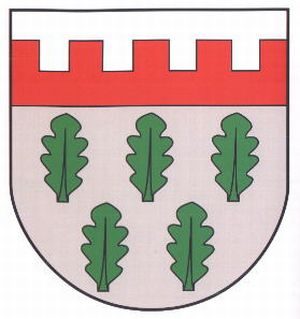 less than 10 m
Coats of Arms
Wappen der Gemeinde Hütterscheid
Farmhouses and Farm Buildings
Winkelhof
Wayside Shrines and Stations of the Cross
Wegekreuz
Schools
Alte Schule
Wayside Shrines and Stations of the Cross
Wegekreuz
Deserted Settlements
Bolzenhof
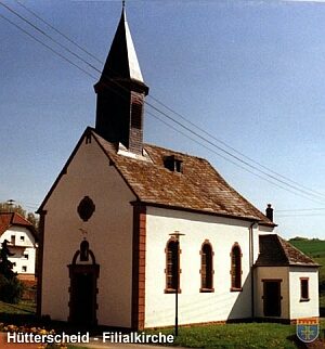 200 m
Catholic Churches
Sankt Anna und Sankt Bernhard
Farmhouses and Farm Buildings