Rocks · Undated
Schwarzer Stein
- Listed monument

Description
This description is only available in German.
Translate with Google opens this page in Google Translate (external service)
Auf Höhenpunkt 636,3 Meter über Normal-Null, etwa 500 Meter südöstlich vom Bromerkopf (661,9 Meter über Normal-Null.)
Classification
- Subject area
- Natural Features
- Category
- Rocks
- Date
- Undatiert
- Period
- Undated
Location
- District
- Bernkastel-Wittlich
- Collective municipality
- Thalfang am Erbeskopf
- Municipality
- Thalfang
- Locality / location
- Forsthaus Deuselbach
- Field name
- Alte Hecke
- Coordinates
- WGS 84: 49.741349, 7.071834 (Position: exact) WGS 84: 49° 44′ 28.9″ N, 7° 04′ 18.6″ E UTM 32 (ETRS89): E 361078 · N 5511658
Sources
Data sources
- Gerhard Lenssen, Bernkastel-Kues, 2005.
On the internet
Picture credits
- Picture 1: © Gerhard Lenssen, Bernkastel-Kues, 2005
Last edited: 6 May 2005 Object ID: 9873
https://kulturdb.de/en/objekt/9873-thalfang-schwarzer-stein
Nearby
The nearest objects
No picture
120 m
Viewpoints
Aussichtspunkt Linas Ruh
 150 m
Commemorative Plantings
Kaisereiche
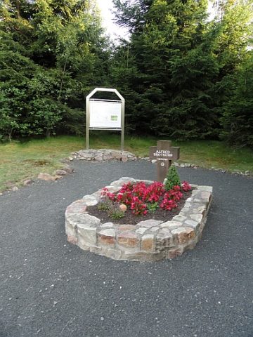 180 m
Burial Sites
Soldatengrab mit Informationstafel
No picture
480 m
Field Names
Buchholz
760 m
Oaks
Eiche am Forsthaus Deuselbach
No picture
850 m
Field Names
Buchholzschlag
No picture
1.1 km
Mills
Ehemalige Sägemühle am Siebenbornbach
 1.1 km
Charcoal Kilns