Saarburg-Kell
3,302 heritage sites in the collective municipality of Saarburg-Kell in the Kulturdatenbank Region Trier.
The map shows all 3,302 results.
-
Fundstellen tierischer Versteinerungen
Geological Features Fossils ID 50967
-
Fundstellen tierischer Versteinerungen
Geological Features Fossils ID 50968
-
Fundstellen tierischer Versteinerungen
Geological Features Fossils ID 50979
-
Gedenkstätte
Markers and Monuments Monuments ID 43014
-
Holländer Birnbaum
Field Names ID 42776
-
Hundstriesch
Field Names ID 44462
-
Im Winkel
Field Names ID 39781
-
Kirchhuf
Field Names ID 46344
-
Kramesmühle
Engineering Structures and Industrial Sites Mills ID 7828
-
Kreuz im Marjeter Forst
Religious Buildings Wayside Shrines and Stations of the Cross ID 24829
-
Marjeter Felsen
Rocks ID 45772
-
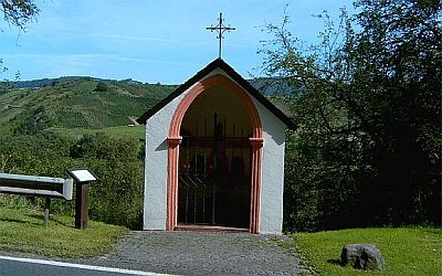
Mutter-Gottes-Kapelle
Religious Buildings Chapels ID 24877
-
Ortsname / Ortsgeschichte
Place Names / Local History ID 2736
-
Rimpertertriesch
Field Names ID 29333
-
Schleifbungert
Field Names ID 28274
-
Spitztriesch
Field Names ID 29335
-
Unter Kreckesborn
Field Names ID 30735
-
Vor Wolfsgalgen
Field Names ID 36712
-
Vor der Wolfsheck
Field Names ID 36713
-
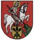
Wappen der Gemeinde Hentern
Coats of Arms ID 2725
-
Wegekreuz
Religious Buildings Wayside Shrines and Stations of the Cross ID 32916
-
Wegekreuz
Religious Buildings Wayside Shrines and Stations of the Cross ID 32917
-
Wegekreuz
Religious Buildings Wayside Shrines and Stations of the Cross ID 32918
-
Wegekreuz
Religious Buildings Wayside Shrines and Stations of the Cross ID 32919
-
Wegekreuz
Religious Buildings Wayside Shrines and Stations of the Cross ID 43013
-
Westwall - Bunker
Baustärke B1 oder stärker
Fortifications and Military Sites Fortresses and Bunkers ID 22636
-
Westwall - Maschinengewehr-Doppelschartenstand
Fortifications and Military Sites Fortresses and Bunkers ID 22566
-
Westwall - Sanitätsstand
Fortifications and Military Sites Fortresses and Bunkers ID 22565
-
Wolfsgalgen
Field Names ID 36711
-
Wegekreuz
Religious Buildings Wayside Shrines and Stations of the Cross ID 26756
-
Alte Roteisensteingrube
Economy, Trade and Transport Extraction and Processing of Raw Materials ID 50520
-
Alter Kelter
Economy, Trade and Transport Extraction and Processing of Raw Materials ID 10929
-
Am vordersten Scharfenberg
Field Names ID 26831
-
Antonius-Kapelle
Religious Buildings Chapels ID 10930
-
Auf Hingert
Field Names ID 26837
-
Auf Pützwild
Field Names ID 39517
-
Auf Vogelsknipp
Field Names ID 37362
-
Auf der Feuerstadt
Field Names ID 26840
-
Auf der Tref
Field Names ID 26845
-
Aufm Hundsberg
Field Names ID 44545
-
Aussichtspunkt
Viewpoints ID 4522
-
Aussichtspunkt Scharfenberg
Viewpoints ID 33144
-
Bei Winkelborn
Field Names ID 30704
-
Bei der Follmühle
Field Names ID 26839
-
Beim Fränschenborn
Field Names ID 30686
-
Beim Pützborn
Field Names ID 30703
-
Beim Winkelborn
Field Names ID 30706