Tourbières de source · Non daté
Oberbirkenbruch und Unterbirkenbruch
Naturdenkmal
- Monument classé

Classification
- Thème
- Éléments naturels
- Catégorie
- Tourbières et marais
- Type d'objet
- Tourbières de source
- Date
- Undatiert
- Période
- Non daté
Localisation
- Arrondissement
- Bernkastel-Wittlich
- Communauté de communes
- Bernkastel-Kues
- Commune
- Hochscheid
- Lieu-dit
- Idarwald
- Coordonnées
- WGS 84 : 49.861550, 7.225020 (Position : exacte) WGS 84 : 49° 51′ 41,6″ N, 7° 13′ 30,1″ E UTM 32 (ETRS89) : E 372431 · N 5524748
Sources
Sources des données
- [1] LANIS - Landschaftsinformationssysten der Naturschutzverwaltung Rheinland-Pfalz, 2015. http://www.naturschutz.rlp.de/?q=naturdenkmal
Sur Internet
Crédits photos
- Image 1: Peter Valerius, Kordel, 2005.
Dernière modification : 2 mai 2015 Identifiant de l'objet : 38426
https://kulturdb.de/fr/objekt/38426-hochscheid-oberbirkenbruch-und-unterbirkenbruch
À proximité
Les objets les plus proches
 260 m
Tourbières de source
Oberbirkenbruch und Unterbirkenbruch
290 m
Tourbières de source
Oberbirkenbruch und Unterbirkenbruch
 650 m
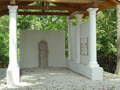
Temples, sanctuaires
Pilgerheiligtum von Hochscheid - Sirona-Tempel
Pas d'image
790 m
Moulins
Hochscheidermühle
Pas d'image
810 m
Moulins
Ehemalige Mühle am Kreischbach
Pas d'image
890 m
Moulins
Ehemalige Mühle am Kreischbach
Pas d'image
1,0 km
Lieux-dits
Unter Hemesrech
Pas d'image
1,0 km
Moulins