Vulkaneifel
7,758 heritage sites in Vulkaneifel in the Kulturdatenbank Region Trier.
The map shows all 7,758 results.
-
Vorn an Killenberg
Field Names ID 52447
-
Vulkangarten Am Steffelnkopf - Station 10
Mehrfach versetzte Tuffschichten
Geological Features ID 19363
-
Vulkangarten Am Steffelnkopf - Station 11
Offene Spalten in Ascheschichten
Geological Features ID 19364
-
Vulkangarten Am Steffelnkopf - Station 13
Experimentierstation Wasser und Maarteephra
Geological Features ID 19366
-
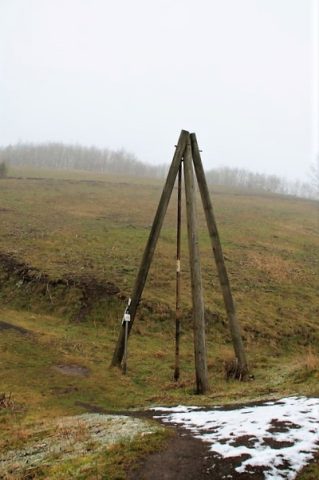
Vulkangarten Am Steffelnkopf - Station 15
Bohrturm "Wassererschließung"
Geological Features ID 19368
-
Vulkangarten Am Steffelnkopf - Station 18
Wasserreservoir für Experimente
Geological Features ID 19371
-
Vulkangarten Am Steffelnkopf - Station 19
Erkaltetes Gesteinsmaterial aus Lavafontänen
Geological Features ID 19372
-
Vulkangarten Am Steffelnkopf - Station 20
Experimentierstation Wasser und Basaltgestein
Geological Features ID 19373
-
Vulkangarten Am Steffelnkopf - Station 21
Experimentierstation Wasser und Basaltschlacken
Geological Features ID 19374
-
Vulkangarten Am Steffelnkopf - Station 22
Schlackenkegelvulkan mit Lavastrom
Geological Features ID 19375
-
Vulkangarten Am Steffelnkopf - Station 23
Channelfüllung eines Aschestroms
Geological Features ID 19376
-
Vulkangarten Am Steffelnkopf - Station 23
Einschlagstrichter mit Gesteinsblöcken
Geological Features ID 19377
-
Vulkangarten Am Steffelnkopf - Station 3
Pflanzkübel aus vulkanischem Material
Geological Features ID 19356
-
Vulkangarten Am Steffelnkopf - Station 6
Aussichtspunkt mit Vulkaneifel-Rundblick
Geological Features ID 19359
-
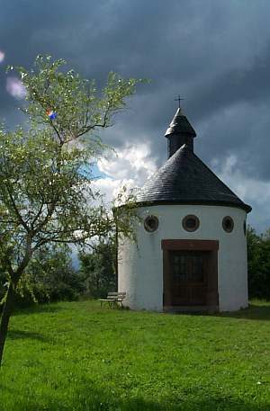
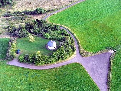
Wallfahrtskapelle Wahlhausen (2)
Religious Buildings Chapels ID 1529
-
Wappen der Gemeinde Steffeln
Coats of Arms ID 4125
-
Wegekreuz
Religious Buildings Wayside Shrines and Stations of the Cross ID 33676
-
Wegekreuz Am Hauböschelschen
Religious Buildings Wayside Shrines and Stations of the Cross ID 32362
-
Wegekreuz Am Hellenstein
Religious Buildings Wayside Shrines and Stations of the Cross ID 33679
-
Wegekreuz An der Rossbach
Religious Buildings Wayside Shrines and Stations of the Cross ID 42800
-
Wegekreuz Kreuzung Hochstraße/Waldstraße
Religious Buildings Wayside Shrines and Stations of the Cross ID 33675
-
Wegekreuz Lindenstraße / Mühlenweg
Religious Buildings Wayside Shrines and Stations of the Cross ID 42799
-
Wegekreuz im Mühlenweg
Religious Buildings Wayside Shrines and Stations of the Cross ID 33678
-
Wegemal Im Bereslauch
Religious Buildings Wayside Shrines and Stations of the Cross ID 32366
-
Wohnhaus
Residential and Farm Buildings Farmhouses and Farm Buildings ID 16374
-
Wüstung Wahlhausen
Settlements Deserted Settlements ID 1020
-
Wüstungsflur Mannerscheid
Economy, Trade and Transport Ancient Field Systems ID 1021
-
Grenz- und Wegekreuz Über der Mühle am Küllenberg
Religious Buildings Wayside Shrines and Stations of the Cross ID 33680
-
Steffelner Mühle am Tieferbach
Engineering Structures and Industrial Sites Mills ID 7785
-
Wegekreuz
Religious Buildings Wayside Shrines and Stations of the Cross ID 25411
-
Am Seitertssuhr
Field Names ID 41579
-
Aufm Brühlsrech
Field Names ID 29906
-
Aufm Drieschpesch
Field Names ID 27501
-
Aussichtspunkt
Viewpoints ID 38924