Fountains and Wells · Renaissance
Höpperbour


Description
This description is only available in German.
Translate with Google opens this page in Google Translate (external service)
Wiederfreigelegter Quellbrunnen am Zellerberg.
Inschrift Plakette:
Ergründet um 1600
Erweitert 1985 [1]
Classification
- Subject area
- Architectural and Art Monuments
- Category
- Fountains and Wells
- Date
- Circa 1500 bis circa 1700
- Period
- Renaissance
Location
- District
- Trier-Saarburg
- Collective municipality
- Schweich an der römischen Weinstraße
- Municipality
- Longen
- Field name
- Beim Höpperborn
- Coordinates
- WGS 84: 49.811799, 6.787980 (Position: exact) WGS 84: 49° 48′ 42.5″ N, 6° 47′ 16.7″ E UTM 32 (ETRS89): E 340860 · N 5520053
Sources
Data sources
- [1] Wolfgang Welter, Schweich, 2005; 2024.
On the internet
Picture credits
Last edited: 5 Nov 2024 Object ID: 10043
https://kulturdb.de/en/objekt/10043-longen-hoepperbour
Nearby
The nearest objects
No picture
110 m
Field Names
Beim Höpperborn
No picture
170 m
Field Names
In der Langheck oberm Kirchenländchen
No picture
210 m
Field Names
Kirchenländchen
 350 m
Field Names
Im Kackertsloch
No picture
380 m
Field Names
Unterm Kirchenländchen
 420 m
Extraction and Processing of Raw Materials
Eisengruben
 440 m
Wayside Shrines and Stations of the Cross
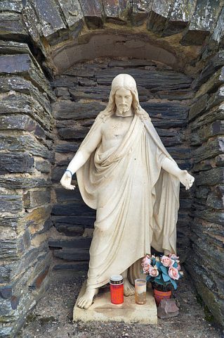
Grotte mit Jesusfigur
No picture
490 m
Viewpoints