Coats of Arms · 20th Century
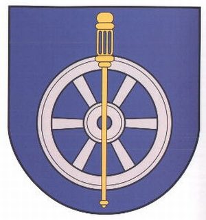
Wappen der Gemeinde Olsdorf

Description
This description is only available in German.
Translate with Google opens this page in Google Translate (external service)
Ausdruck der landwirtschaftlichen Struktur des Ortes ist das silberne Pflugrad auf blauen Grund, belegt mit dem Attribut des Kirchenpatrones Sankt Rochus, einem Pilgerstab.
Classification
- Subject area
- History
- Category
- Coats of Arms
- Date
- 12.03.1989 [Genehmigung]
- Period
- 20th Century
Location
- District
- Eifelkreis Bitburg-Prüm
- Collective municipality
- Bitburger Land
- Municipality
- Olsdorf
- Field name
- Ortslage
- Coordinates
- WGS 84: 49.954236, 6.382936 (Position: within the village) WGS 84: 49° 57′ 15.2″ N, 6° 22′ 58.6″ E UTM 32 (ETRS89): E 312276 · N 5536826
Sources
Data sources
- Homepage der Verbandsgemeinde Bitburg-Land http://www.bitburg-land.de/
On the internet
bitburgerland.de/index.php?id=430
Picture credits
- Picture 1: http://www.ngw.nl/int/dld/o/olsdorf.htm
Last edited: 5 Sep 2005 Object ID: 10215
https://kulturdb.de/en/objekt/10215-olsdorf-wappen-der-gemeinde-olsdorf
Nearby
The nearest objects
 less than 10 m
Place Names / Local History
Erste Erwähnung als Alesdorf juxta Bettingen
Wayside Shrines and Stations of the Cross
Wegekreuz
 280 m
Chapels
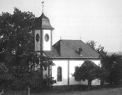
Sankt Rochuskapelle beim Hoorhof
Place Names / Local History
Ortsgeschichte Hoorhof
Settlements
Römische Siedlungsstelle
Field Names
Beim Ack
Field Names
Bei Engelsborn
Field Names