Place Names / Local History · Baroque / Rococo
Ortsgeschichte Hoorhof
- Listed monument


© GeoBasis-DE / LVermGeoRP, dl-de/by-2-0
There is no picture of this object yet. Do you have a photo that you would like to make available to the Kulturdatenbank? Submit a picture
Description
This description is only available in German.
Translate with Google opens this page in Google Translate (external service)
[...] Der 1767 errichtete Hoorhof bildete bis 1905 eine eigene Gemeinde. Der in Zweitverwertung eingesetzte Keilstein seines Scheunentores ist 1792 datiert.
Aufgrund der Teilung des Guts bestand er um 1850 aus zwei Wohnhäusern mit neun Bewohnern.
[...]
Classification
- Subject area
- History
- Category
- Place Names / Local History
- Date
- 1767
- Period
- Baroque / Rococo
Location
- District
- Eifelkreis Bitburg-Prüm
- Collective municipality
- Bitburger Land
- Municipality
- Olsdorf
- Locality / location
- Hoorhof
- Field name
- Ortslage
- Coordinates
- WGS 84: 49.956833, 6.383556 (Position: exact) WGS 84: 49° 57′ 24.6″ N, 6° 23′ 00.8″ E UTM 32 (ETRS89): E 312330 · N 5537113
Sources
Data sources
- Denkmaltopographie Bundesrepublik Deutschland, Kulturdenkmäler in Rheinland-Pfalz, Kreis Bitburg-Prüm, 9.2 Wernersche Verlagsgesellschaft 1994. ISBN 3-88462-132-7
On the internet
Last edited: 12 Sep 2005 Object ID: 10283
https://kulturdb.de/en/objekt/10283-olsdorf-ortsgeschichte-hoorhof
Nearby
The nearest objects
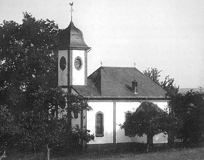 60 m
Chapels
Sankt Rochuskapelle beim Hoorhof
 290 m
Place Names / Local History
Erste Erwähnung als Alesdorf juxta Bettingen
290 m
Coats of Arms
Wappen der Gemeinde Olsdorf
Settlements
Römische Siedlungsstelle
Field Names
Im Engelsborn
Field Names
Bei Engelsborn
Wayside Shrines and Stations of the Cross
Wegekreuz
Wayside Shrines and Stations of the Cross