Historic Townscapes · Neoclassicism
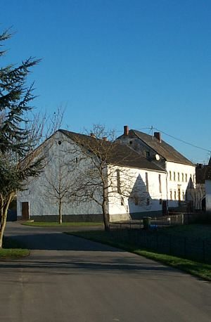
Denkmalzone Hauptstraße 11 und 12
- Listed monument

Description
This description is only available in German.
Translate with Google opens this page in Google Translate (external service)
Diese Gebäude besaßen zentrale Funktionen im Dorf.
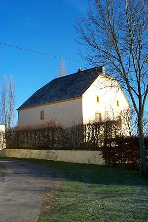
Nr.11 ist die ehemalige Schule und wurde laut Inschrift 1821 erbaut und 1908 erweitert. Nr. 12 ist ein ehemaliges Pfarrhaus.
Classification
- Subject area
- Architectural and Art Monuments
- Category
- Historic Townscapes
- Date
- 1821
- Period
- Neoclassicism
Location
- District
- Eifelkreis Bitburg-Prüm
- Collective municipality
- Bitburger Land
- Municipality
- Dockendorf
- Street
- Hauptstraße 11, 12
- Field name
- Zehrengarten
- Coordinates
- WGS 84: 49.926736, 6.456836 (Position: exact) WGS 84: 49° 55′ 36.2″ N, 6° 27′ 24.6″ E UTM 32 (ETRS89): E 317472 · N 5533586
Sources
Data sources
- Homepage der Initiative Region Trier e.V. Sehen & Erleben - Bau-Denkmäler http://www.regiontrier.de/cgi/bin
On the internet
de.wikipedia.org/wiki/Dockendorf
Picture credits
- Picture 1: Google Earth
Last edited: 4 Dec 2007 Object ID: 10580
https://kulturdb.de/en/objekt/10580-dockendorf-denkmalzone-hauptstrasse-11-und-12
Nearby
The nearest objects
 30 m
Rectories
Altes Pfarrhaus
Farmhouses and Farm Buildings
Scheunenbau
110 m
House and Villa Gardens
Gartenanlage Altes Pfarrhaus
 140 m
Historic Townscapes
Historisches Ortsbild
 140 m
Place Names / Local History
Erste Erwähnung als Duckendorf
 140 m
Coats of Arms
Wappen der Gemeinde Dockendorf
 140 m
Farmhouses and Farm Buildings
Bäuerliches Wohnhaus
Farmhouses and Farm Buildings