Extraction and Processing of Raw Materials · Historicism / Art Nouveau
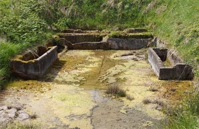
Eisenerzabbau am Eisenkopf


© GeoBasis-DE / LVermGeoRP, dl-de/by-2-0
There is no picture of this object yet. Do you have a photo that you would like to make available to the Kulturdatenbank? Submit a picture
Description
This description is only available in German.
Translate with Google opens this page in Google Translate (external service)
Bis um 1860 grub man hier Eisenerz im Tagebau, das in Quint bei Trier, Philipsheim und Malberg verarbeitet wurde. [1]
Classification
- Subject area
- Architectural and Art Monuments
- Category
- Economy, Trade and Transport
- Object type
- Extraction and Processing of Raw Materials
- Date
- 1860
Location
- District
- Eifelkreis Bitburg-Prüm
- Collective municipality
- Bitburger Land
- Municipality
- Gindorf
- Field name
- Auf Eisenkopf
- Coordinates
- WGS 84: 50.002208, 6.651309 (Position: presumed) WGS 84: 50° 00′ 07.9″ N, 6° 39′ 04.7″ E UTM 32 (ETRS89): E 331692 · N 5541520
Sources
Data sources
- [1] Karl E. Becker: Das Kyllburger Land. Kyllburg 1977. Hrsg. Verbandsgemeinde Kyllburg.
On the internet
Last edited: 8 Nov 2007 Object ID: 13434
https://kulturdb.de/en/objekt/13434-gindorf-eisenerzabbau-am-eisenkopf
Nearby
The nearest objects
Field Names
Weilbach
Field Names
Auf Eisenkopf
Field Names
Eisenkopf
 400 m
Washing Places
Waschhaus im Weilbachtal
Field Names
Auf Kreuzacker
Field Names
Dellwiese
Field Names
Vor der Höhe
Castles