Farmhouses and Farm Buildings · Renaissance
Haus Dierfeld
- Listed monument

Description
This description is only available in German.
Translate with Google opens this page in Google Translate (external service)
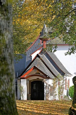
Ehemals befestigtes Hofgut des Grafen von Manderscheid. Wohnhaus um Mitte des 16. Jahrhunderts mit achtseitigem Treppenturm vor der Mitte der Hoffront. Schlichte Kapelle um 1700. [1]
Classification
- Subject area
- Architectural and Art Monuments
- Category
- Residential and Farm Buildings
- Object type
- Farmhouses and Farm Buildings
- Date
- Mitte des 16. Jahrhunderts
- Period
- Renaissance
Location
- District
- Bernkastel-Wittlich
- Collective municipality
- Wittlich-Land
- Municipality
- Dierfeld
- Field name
- Ober dem Garten
- Coordinates
- WGS 84: 50.084141, 6.889185 (Position: exact) WGS 84: 50° 05′ 02.9″ N, 6° 53′ 21.1″ E UTM 32 (ETRS89): E 348994 · N 5550120
Sources
Data sources
- [1] Georg Dehio: Handbuch der deutschen Kunstdenkmäler: Rheinland-Pfalz, Saarland, 1984. Deutscher Kunstverlag
On the internet
Picture credits
- Picture 1: Von Thomas Hummel - Eigenes Werk, CC BY-SA 4.0, https://commons.wikimedia.org/w/index.php?curid=112255896
Last edited: 18 Dec 2021 Object ID: 14883
https://kulturdb.de/en/objekt/14883-dierfeld-haus-dierfeld
Nearby
The nearest objects
Museums
Gemäldesammlung
 less than 10 m
Chapels
Kapelle am Haus Dierfeld
Place Names / Local History
Erste urkundliche Erwähnung
Settlements
Reste einer römischen Villa (1)
Settlements
Reste einer römischen Villa (2)
Field Names
Ochsentriesch
Wayside Shrines and Stations of the Cross
Hölzernes Kruzifix
Christian Cemeteries