Schools · Historicism / Art Nouveau
Ehemalige Schule
- Listed monument


Description
This description is only available in German.
Translate with Google opens this page in Google Translate (external service)
Classification
- Subject area
- Architectural and Art Monuments
- Category
- Educational Institutions
- Object type
- Schools
- Date
- Um 1900
Location
- District
- Vulkaneifel
- Town
- Daun
- Locality / location
- Steinborn
- Street
- Steinborner Straße 36
- Field name
- Ortslage
- Coordinates
- WGS 84: 50.212246, 6.789672 (Position: exact) WGS 84: 50° 12′ 44.1″ N, 6° 47′ 22.8″ E UTM 32 (ETRS89): E 342298 · N 5564568
Sources
Data sources
- [1] Kreisverwaltung Vulkaneifel, Abteilung 1 - Kommunales und Recht; 2008
- [2] Friedbert Wißkirchen, Daun, 2009.
On the internet
Picture credits
Last edited: 20 Jun 2009 Object ID: 16551
https://kulturdb.de/en/objekt/16551-daun-ehemalige-schule
Nearby
The nearest objects
No picture
less than 10 m
Wayside Shrines and Stations of the Cross
Wegekreuz
 20 m
Ash Trees
Esche
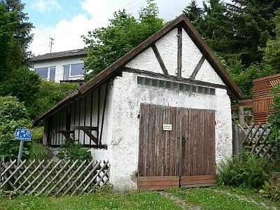 50 m
Engineering Structures and Industrial Sites
Altes Spritzenhaus
No picture
60 m
Wayside Shrines and Stations of the Cross
Wegekreuz
60 m
Pear Trees
Alter Birnbaum
No picture
100 m
Field Names
Auf dem krummen Acker
No picture
120 m
Farmhouses and Farm Buildings
Trierer Haus
No picture
130 m
Farmhouses and Farm Buildings