Wayside Shrines and Stations of the Cross · 20th Century
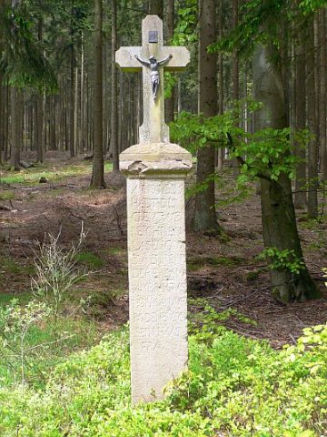
Sogenanntes Roden-Kreuz

Description
This description is only available in German.
Translate with Google opens this page in Google Translate (external service)
Das Kreuz befindet sich an einem Waldweg auf der "Köhlerroute", westlich von Eisenschmitt. [1]
Classification
- Subject area
- Architectural and Art Monuments
- Category
- Religious Buildings
- Object type
- Wayside Shrines and Stations of the Cross
- Date
- Nach 1945
- Period
- 20th Century
Location
- District
- Bernkastel-Wittlich
- Collective municipality
- Wittlich-Land
- Municipality
- Bettenfeld
- Field name
- Huschberg
- Coordinates
- WGS 84: 50.065135, 6.730535 (Position: exact) WGS 84: 50° 03′ 54.5″ N, 6° 43′ 49.9″ E UTM 32 (ETRS89): E 337581 · N 5548340
Sources
Data sources
- [1] Uwe Widera, 2009.
On the internet
Picture credits
- Picture 1: © Uwe Widera, 54550 Daun, 2009.
Last edited: 28 May 2009 Object ID: 17201
https://kulturdb.de/en/objekt/17201-bettenfeld-sogenanntes-roden-kreuz
Nearby
The nearest objects
 470 m
Wayside Shrines and Stations of the Cross
Sandsteinkreuz von 1635
Field Names
In Minderroth
Wayside Shrines and Stations of the Cross
Wegekreuz
Deserted Settlements
Wüstung Minderroth
 1.2 km
Charcoal Kilns
Ehemaliger Meilerplatz
Fountains and Wells
Ehemaliger Calter Brunnen
1.2 km
Charcoal Kilns
Ehemaliger Meilerplatz
1.3 km
Charcoal Kilns