Wayside Shrines and Stations of the Cross · Undated
Zerstörtes Wegekreuz


Description
This description is only available in German.
Translate with Google opens this page in Google Translate (external service)
An der Landesstraße 67. [1]
Classification
- Subject area
- Architectural and Art Monuments
- Category
- Religious Buildings
- Object type
- Wayside Shrines and Stations of the Cross
- Date
- Undatiert
- Period
- Undated
Location
- District
- Vulkaneifel
- Collective municipality
- Daun
- Municipality
- Dreis-Brück
- Locality / location
- Dreis
- Field name
- Die Hermeswies
- Coordinates
- WGS 84: 50.252065, 6.812511 (Position: exact) WGS 84: 50° 15′ 07.4″ N, 6° 48′ 45.0″ E UTM 32 (ETRS89): E 344057 · N 5568946
Sources
Data sources
- [1] Uwe Widera, 54550 Daun, 2010.
On the internet
Picture credits
Last edited: 29 Mar 2010 Object ID: 18309
https://kulturdb.de/en/objekt/18309-dreis-brueck-zerstoertes-wegekreuz
Nearby
The nearest objects
No picture
110 m
Field Names
Holl Sur
No picture
110 m
Burial Mounds
Grabhügel
No picture
120 m
Burial Mounds
Grabhügel
No picture
140 m
Burial Mounds
Grabhügel
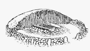 250 m
Burial Mounds
Hügelgrab
No picture
630 m
Field Names
Langsitter
No picture
670 m
Settlements
Römische Hausgrundrisse
No picture
710 m
Field Names