Mineral Springs · Undated
Sauerbrunnen im Hasbachtal


Classification
- Subject area
- Natural Features
- Category
- Springs
- Object type
- Mineral Springs
- Date
- Undatiert
- Period
- Undated
Location
- District
- Vulkaneifel
- Collective municipality
- Daun
- Municipality
- Dockweiler
- Field name
- Dockweiler Wald
- Coordinates
- WGS 84: 50.243153, 6.811982 (Position: exact) WGS 84: 50° 14′ 35.4″ N, 6° 48′ 43.1″ E UTM 32 (ETRS89): E 343990 · N 5567957
Sources
Data sources
- [1] Friedbert Wißkirchen, Daun, 2014.
On the internet
Picture credits
Last edited: 14 Sep 2014 Object ID: 18311
https://kulturdb.de/en/objekt/18311-dockweiler-sauerbrunnen-im-hasbachtal
Nearby
The nearest objects
No picture
590 m
Field Names
Auf der Hufe
No picture
670 m
Burial Mounds
Grabhügelnekropole
No picture
690 m
Settlements
Hausfundamente
No picture
700 m
Field Names
Auf der Hufe
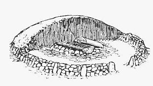 850 m
Burial Mounds
Hügelgrab
No picture
870 m
Burial Mounds
Grabhügel
No picture
890 m
Burial Mounds
Grabhügel
No picture
920 m
Burial Mounds