Settlements · Celtic / Roman Period
Römischer Siedlungsplatz

Classification
- Subject area
- Archaeological Monuments
- Category
- Settlements
- Object type
- Settlements
- Date
- Circa 500 vor Chr. bis circa 500 nach Chr.
- Period
- Celtic / Roman Period
Location
- District
- Bernkastel-Wittlich
- Collective municipality
- Bernkastel-Kues
- Municipality
- Hochscheid
- Field name
- Unterbirkenbruch
- Coordinates
- WGS 84: 49.867647, 7.240298 (Position: exact) WGS 84: 49° 52′ 03.5″ N, 7° 14′ 25.1″ E UTM 32 (ETRS89): E 373545 · N 5525400
Sources
Data sources
- Leipziger online-Beiträge zur Ur- und Frühgeschichtlichen Archäologie 31. Herausgegeben von Sabine Rieckhoff, Wolf-Rüdiger Teegen und Sabine Wolfram. Leipzig 2008. ISSN 1612-4227. http://www.uni-leipzig.de
On the internet
Picture credits
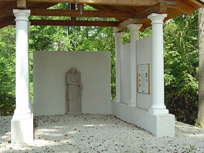
- Picture 1: © Lothar Monshausen, Fotostream http://www.flickr.com/photos/lomo56/tags/meteorite/
Last edited: 21 Jul 2010 Object ID: 18674
https://kulturdb.de/en/objekt/18674-hochscheid-roemischer-siedlungsplatz
Nearby
The nearest objects
 640 m
Temples, Sanctuaries
Pilgerheiligtum von Hochscheid - Sirona-Tempel
No picture
920 m
Mills
Ehemalige Mühle am Altbach
No picture
1,000 m
Mills
Ehemalige Kuhnenmühl am Altbach
No picture
1,000 m
Mills
Hochscheidermühle
 1.0 km
Spring Fens
Oberbirkenbruch und Unterbirkenbruch
No picture
1.0 km
Field Names
Im untersten Grund
No picture
1.1 km
Field Names
In der Steinkaul
No picture
1.4 km
Field Names