Extraction and Processing of Raw Materials · Historicism / Art Nouveau
Steinbruch Im Steinberg


© GeoBasis-DE / LVermGeoRP, dl-de/by-2-0
There is no picture of this object yet. Do you have a photo that you would like to make available to the Kulturdatenbank? Submit a picture
Classification
- Subject area
- Architectural and Art Monuments
- Category
- Economy, Trade and Transport
- Object type
- Extraction and Processing of Raw Materials
- Date
- Circa 1850 bis 1920
Location
- District
- Eifelkreis Bitburg-Prüm
- Collective municipality
- Bitburger Land
- Town
- Kyllburg
- Field name
- Im Steinberg
- Coordinates
- WGS 84: 50.043105, 6.608448 (Position: exact) WGS 84: 50° 02′ 35.2″ N, 6° 36′ 30.4″ E UTM 32 (ETRS89): E 328766 · N 5546163
Sources
Data sources
- [1] Topographische Karte von 1886.
On the internet
Last edited: 17 Feb 2010 Object ID: 18919
https://kulturdb.de/en/objekt/18919-kyllburg-steinbruch-im-steinberg
Nearby
The nearest objects
No picture
340 m
Field Names
Hinterm Grabenpesch
No picture
450 m
Cremation Graves
RömeRuhrnen
No picture
500 m
Natural Landscapes
Ehemalige Hopfenanpflanzungen am Rosenberg
No picture
510 m
Fords
Ehemalige Furt durch die Kyll
 600 m
Natural Landscapes
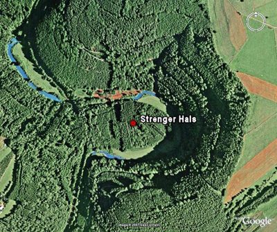
Strenger Hals
No picture
700 m
Fossils
Fundstellen tierischer Versteinerungen
No picture
720 m
Field Names
Im Klopp
No picture
720 m
Fords