Wayside Shrines and Stations of the Cross · Baroque / Rococo
Grafen- oder Schwedenkreuz (2)
- Listed monument




Description
This description is only available in German.
Translate with Google opens this page in Google Translate (external service)
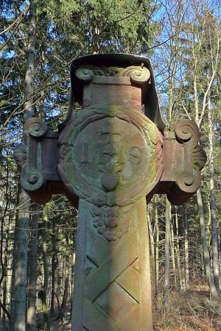
Nordwestlich der Ortslage am alten Weg nach Kerpen: Wegekreuz; Balkenkreuz, angeblich von 1773. [1]
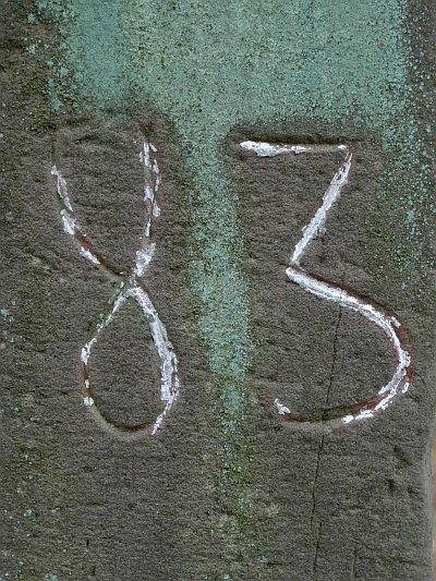
83 = Walddistrikt?
KW = Königlicher Wald
1981 A.H. = Renovierungsvermerk?
[Redaktion]
Classification
- Subject area
- Architectural and Art Monuments
- Category
- Religious Buildings
- Object type
- Wayside Shrines and Stations of the Cross
- Date
- 1773
- Period
- Baroque / Rococo
Location
- District
- Vulkaneifel
- Collective municipality
- Gerolstein
- Municipality
- Kerpen (Eifel)
- Locality / location
- Loogh
- Field name
- In der Lay
- Coordinates
- WGS 84: 50.302079, 6.733193 (Position: exact) WGS 84: 50° 18′ 07.5″ N, 6° 43′ 59.5″ E UTM 32 (ETRS89): E 338572 · N 5574676
Sources
Data sources
- [1] Denkmalliste der Generaldirektion Kulturelles Erbe, Rheinland-Pfalz; 2010.
On the internet
Picture credits
Last edited: 7 Mar 2011 Object ID: 22914
https://kulturdb.de/en/objekt/22914-kerpen-eifel-grafen-oder-schwedenkreuz-2
Nearby
The nearest objects
 less than 10 m
Wayside Shrines and Stations of the Cross
Grafen- oder Schwedenkreuz (1)
Rocks
Zeppichlay
Field Names
Im Jungfernpesch
Field Names
Rudelspesch
 350 m
Catholic Churches
Kreuz vor Sankt Wendelin, Joseph und Barbara
Field Names
Auf Mungendriesch
Field Names
Im krummen Acker
 440 m
Field Names