Wayside Shrines and Stations of the Cross · Renaissance
Kreuzigungsbildstock
- Listed monument


Description
This description is only available in German.
Translate with Google opens this page in Google Translate (external service)
Am Kreuzfuss 1626 datierter Schaftbildstock auf einem späteren Altarblock. [1]
Classification
- Subject area
- Architectural and Art Monuments
- Category
- Religious Buildings
- Object type
- Wayside Shrines and Stations of the Cross
- Date
- 1626
- Period
- Renaissance
Location
- District
- Trier-Saarburg
- Collective municipality
- Trier-Land
- Municipality
- Langsur
- Street
- Mesenicher Straße 30
- Field name
- Ortslage
- Coordinates
- WGS 84: 49.725380, 6.499740 (Position: exact) WGS 84: 49° 43′ 31.4″ N, 6° 29′ 59.1″ E UTM 32 (ETRS89): E 319804 · N 5511098
Sources
Data sources
- [1] Denkmaltopographie Bundesrepublik Deutschland. Kulturdenkmäler in Rheinland-Pfalz. Band 12.2 Kreis Trier-Saarburg. Wernersche Verlagsgesellschaft mbH, Worms. ISBN 3-88462-110-6 (1. Auflage 1994).
On the internet
Picture credits
Last edited: 10 May 2013 Object ID: 2311
https://kulturdb.de/en/objekt/2311-langsur-kreuzigungsbildstock
Nearby
The nearest objects
 80 m
Town Houses and Commercial Buildings
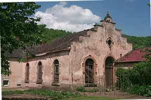
Saalbau
Wayside Shrines and Stations of the Cross
Wegekreuz
Settlements
Mauern eines römischen Gebäudes
Place Names / Local History
Ortsname / Ortsgeschichte
Jewish History
Jüdische Geschichte
War Memorials
Kriegerdenkmal am Friedhof
Fortresses and Bunkers
Westwall - Maschinengewehr-Doppelschartenstand
Chapels