Town Houses and Commercial Buildings · Neoclassicism
Haus Unter der Pfordt 50
Denkmalzone Unter der Pfordt
- Listed monument


Classification
- Subject area
- Architectural and Art Monuments
- Category
- Residential and Farm Buildings
- Object type
- Town Houses and Commercial Buildings
- Date
- Circa 1780 bis 1850
- Period
- Neoclassicism
Location
- District
- Eifelkreis Bitburg-Prüm
- Collective municipality
- Prüm
- Municipality
- Schönecken
- Street
- Unter der Pfordt 50
- Field name
- Ortslage
- Coordinates
- WGS 84: 50.158463, 6.464208 (Position: exact) WGS 84: 50° 09′ 30.5″ N, 6° 27′ 51.1″ E UTM 32 (ETRS89): E 318876 · N 5559328
Sources
Data sources
- [1] Denkmaltopographie Bundesrepublik Deutschland, Kulturdenkmäler in Rheinland-Pfalz, Kreis Bitburg-Prüm, 9.3 Wernersche Verlagsgesellschaft ISBN 3-88462-170-X
On the internet
Picture credits
Last edited: 23 Jun 2011 Object ID: 23251
https://kulturdb.de/en/objekt/23251-schoenecken-haus-unter-der-pfordt-50
Nearby
The nearest objects
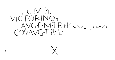 20 m
Markers and Monuments
Meilenstein
No picture
30 m
Farmhouses and Farm Buildings
Quereinhaus
No picture
30 m
Farmhouses and Farm Buildings
Oberlichtportal
 30 m
Springs
Zapps Born - Sogenannter Schönecker Bor
 40 m
Castles
Haus Arenth
No picture
40 m
Farmhouses and Farm Buildings
Haustürgewände
No picture
40 m
Town Houses and Commercial Buildings
Unter der Pfordt 51
 50 m
Road Transport