Legal Monuments · Merovingian Period
Merowingermauer
- Listed monument

Description
This description is only available in German.
Translate with Google opens this page in Google Translate (external service)
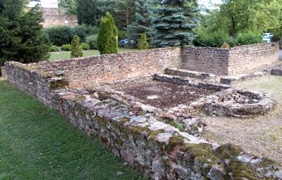
Merowingermauer, die die Immunität (Bezirk eigener Gerichtsbarkeit) der um 640 nach Christus gegründeten adeligen Benediktinerinnenabtei Sankt Irminen umschloss.
Classification
- Subject area
- History
- Category
- Legal Monuments
- Date
- Um 640 nach Christus
- Period
- Merovingian Period
Location
- District
- City of Trier
- Collective municipality
- Verbandsfreie Gemeinde Trier
- Town
- Trier
- Locality / location
- Mitte-Gartenfeld
- Street
- Windmühlenstraße
- Field name
- Ortslage
- Coordinates
- WGS 84: 49.756757, 6.634242 (Position: exact) WGS 84: 49° 45′ 24.3″ N, 6° 38′ 03.3″ E UTM 32 (ETRS89): E 329607 · N 5514272
Sources
Data sources
- Info-Tafel an der Mauer
On the internet
de.wikipedia.org/wiki/Trier-Mitte/Gartenfeld
Picture credits
- Picture 1: © Peter Valerius, Kordel, 2011.
Last edited: 27 Aug 2011 Object ID: 23469
https://kulturdb.de/en/objekt/23469-trier-merowingermauer
Nearby
The nearest objects
 20 m
Windmills
Ehemalige Windmühle
 40 m
Recreation and Sports Facilities
Römische Bäderanlage
Street Names
In der Olk
Town Houses and Commercial Buildings
Wohnhaus
Town Houses and Commercial Buildings
Wohnhaus
Town Houses and Commercial Buildings
Wohnhaus
Town Houses and Commercial Buildings
Wohnhaus
Town Houses and Commercial Buildings