Chapels · Neoclassicism
Ehemalige Kapelle
Wüstung


Description
This description is only available in German.
Translate with Google opens this page in Google Translate (external service)
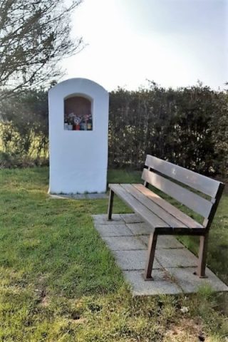
1811 zeigt die Tranchot-Karte Blatt 180 Manderscheid hier ein Gebäude mit dem Zusatz Chap., also eine Wegkapelle. Heute steht hier nur noch ein Wegkreuz. [1]
Classification
- Subject area
- Archaeological Monuments
- Category
- Religious Buildings
- Object type
- Chapels
- Date
- Circa 1750 bis 1850
- Period
- Neoclassicism
Location
- District
- Bernkastel-Wittlich
- Collective municipality
- Traben-Trarbach
- Municipality
- Willwerscheid
- Field name
- Thommen
- Coordinates
- WGS 84: 50.035975, 6.925257 (Position: exact) WGS 84: 50° 02′ 09.5″ N, 6° 55′ 30.9″ E UTM 32 (ETRS89): E 351426 · N 5544693
Sources
Data sources
- [1] Janssen, W.: Studien zur Wüstungsfrage im fränkischen Altsiedelland zwischen Rhein, Mosel und Eifelnordrand. 2 Bände. Text u. Katalog, 1975.
On the internet
Picture credits
Last edited: 28 Aug 2007 Object ID: 273
https://kulturdb.de/en/objekt/273-willwerscheid-ehemalige-kapelle
Nearby
The nearest objects
 20 m
Wayside Shrine Houses
Heiligenhäuschen
Wayside Shrines and Stations of the Cross
Wegekreuz
Chapels
Wegekapelle
Settlements
Römische Mauerreste mit Ziegeln
Field Names
Steinrausch
Field Names
Borpesch
Field Names
Hinterm Grabenpesch
Fortresses and Bunkers