Field Names · Undated
Aufm Honigsberg


© GeoBasis-DE / LVermGeoRP, dl-de/by-2-0
There is no picture of this object yet. Do you have a photo that you would like to make available to the Kulturdatenbank? Submit a picture
Description
This description is only available in German.
Translate with Google opens this page in Google Translate (external service)
Zu althochdeutsch honag, honec, honang, mittelhochdeutsch. honec, honic st. N. ‚Honig‘. Die Namen sind unterschiedlich motiviert. Zum Teil wird vielleicht direkt auf Plätze angespielt, die bei der Honiggewinnung eine Rolle spielten, vor allem die Honigbäume mit Wildbienenstöcken. Daneben nehmen andere Namen in übertragenem Sinn auf besonders fruchtbare, ertragreiche Äcker und Wiesen (oder auch Wiesen mit süßem Gras) Bezug.[…]
Classification
- Subject area
- History
- Category
- Field Names
- Date
- Undatiert
- Period
- Undated
Location
- District
- Eifelkreis Bitburg-Prüm
- Collective municipality
- Bitburger Land
- Municipality
- Oberkail
- Field name
- Aufm Honigsberg
- Coordinates
- WGS 84: 50.029150, 6.677039 (Position: exact) WGS 84: 50° 01′ 44.9″ N, 6° 40′ 37.3″ E UTM 32 (ETRS89): E 333629 · N 5544457
Sources
Data sources
- Mittelhessisches Flurnamenbuch © Hessisches Landesamt für geschichtliche Landeskunde
On the internet
Last edited: 30 Jun 2013 Object ID: 28983
https://kulturdb.de/en/objekt/28983-oberkail-aufm-honigsberg
Nearby
The nearest objects
Field Names
Am Eulendorfergrund
Field Names
Unterm Honigsberg
 300 m
Settlements
Römische Siedlungsstelle
 320 m
Wayside Shrines and Stations of the Cross
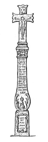
Spätbarockes Schaftkreuz (1)
 320 m
Wayside Shrines and Stations of the Cross
Spätbarockes Schaftkreuz (1)
 360 m
Execution Sites
Galgen
Wayside Shrines and Stations of the Cross
Unglückskreuz an der Straße nach Gindorf
Lime Kilns