Wayside Shrines and Stations of the Cross · 20th Century
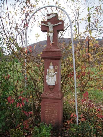
Wegekreuz


Description
This description is only available in German.
Translate with Google opens this page in Google Translate (external service)
Beim Höhenpunkt 316,2 Meter über Normal-Null.
Inschrift:
INRI
18 um 00
Frw.
Feuer
wehr
Mauel
1982 [1]
Classification
- Subject area
- Architectural and Art Monuments
- Category
- Religious Buildings
- Object type
- Wayside Shrines and Stations of the Cross
- Date
- 1982
- Period
- 20th Century
- Creator, builder, architect, artist
- Freiwillige Feuerwehr Mauel.
Location
- District
- Eifelkreis Bitburg-Prüm
- Collective municipality
- Arzfeld
- Municipality
- Mauel
- Field name
- Auf der Schmitt
- Coordinates
- WGS 84: 50.076612, 6.388153 (Position: exact) WGS 84: 50° 04′ 35.8″ N, 6° 23′ 17.4″ E UTM 32 (ETRS89): E 313126 · N 5550416
Sources
Data sources
- [1] Sandra Wack, Neuheilenbach, 2019. www.koerbchen-gesucht.de
On the internet
Picture credits
- Picture 1: © Sandra Wack, Neuheilenbach, 2019. www.koerbchen-gesucht.de
- Picture 2: © Sandra Wack, Neuheilenbach, 2019. www.koerbchen-gesucht.de
- Picture 3: © Sandra Wack, Neuheilenbach, 2019. www.koerbchen-gesucht.de
- Picture 4: © Sandra Wack, Neuheilenbach, 2019. www.koerbchen-gesucht.de
- Picture 5: © Sandra Wack, Neuheilenbach, 2019. www.koerbchen-gesucht.de
Last edited: 22 Nov 2020 Object ID: 33952
https://kulturdb.de/en/objekt/33952-mauel-wegekreuz
Nearby
The nearest objects
No picture
50 m
Viewpoints
Aussichtspunkt
No picture
150 m
Field Names
Michelntriesch
No picture
160 m
Field Names
Michelntriesch
No picture
220 m
Field Names
Auf den Dellhecken
No picture
220 m
Field Names
Michelntriesch
 360 m
Wayside Shrines and Stations of the Cross
Hohes Schaftkreuz
No picture
360 m
Field Names
Breitwiese
 410 m
Historic Townscapes