Windmills · Neoclassicism
Ehemalige Windmühle


Classification
- Subject area
- Architectural and Art Monuments
- Object type
- Windmills
- Date
- 1783
- Period
- Neoclassicism
Location
- District
- Eifelkreis Bitburg-Prüm
- Town
- Prüm
- Street
- Kalvarienbergstraße
- Field name
- Ortslage
- Coordinates
- WGS 84: 50.207210, 6.417360 (Position: presumed) WGS 84: 50° 12′ 26.0″ N, 6° 25′ 02.5″ E UTM 32 (ETRS89): E 315718 · N 5564862
Sources
Data sources
- Faas, Franz Josef: Prüm und das Prümer Land 1700-1945. Hrsg.: Verbandsgemeinde Prüm, 1986.
On the internet
Picture credits
Last edited: 17 May 2015 Object ID: 38621
https://kulturdb.de/en/objekt/38621-pruem-ehemalige-windmuehle
Nearby
The nearest objects
No picture
20 m
Chapels
Pockenkapelle
No picture
30 m
Town Parks and Public Green Spaces
Sogenannter Ölgarten
No picture
30 m
Wayside Shrines and Stations of the Cross
Bildstock im Ölgarten
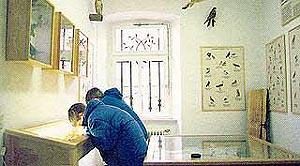 170 m
Museums
Museum
 190 m
Museums
Heimatmuseum
No picture
200 m
Wayside Shrines and Stations of the Cross
Kreuzweg - 3. Station
 210 m
Exhibitions, Cultural Centres and Memorial Sites
Geschichtsverein Prümer Land
No picture
300 m
Monastic Complexes