Mills · Neoclassicism
Ehemalige Mühle am Marbach


© GeoBasis-DE / LVermGeoRP, dl-de/by-2-0
There is no picture of this object yet. Do you have a photo that you would like to make available to the Kulturdatenbank? Submit a picture
Classification
- Subject area
- Architectural and Art Monuments
- Object type
- Mills
- Date
- Circa 1780 bis 1850
- Period
- Neoclassicism
Location
- District
- Vulkaneifel
- Collective municipality
- Daun
- Municipality
- Immerath
- Locality / location
- Immerathermühle
- Field name
- Mühlenberg
- Coordinates
- WGS 84: 50.118800, 6.971880 (Position: exact) WGS 84: 50° 07′ 07.7″ N, 6° 58′ 18.8″ E UTM 32 (ETRS89): E 355014 · N 5553809
Sources
Data sources
- [1] Kartenaufnahme der Rheinlande durch Tranchot und von Müffling (1803 - 1820)
On the internet
Last edited: 31 Jan 2016 Object ID: 40520
https://kulturdb.de/en/objekt/40520-immerathermuehle-ehemalige-muehle-am-marbach
Nearby
The nearest objects
No picture
290 m
Field Names
Aufm Maarberg unter dem Wittumhof
 330 m
Mills
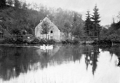
Immerathermühle am Marbach
No picture
470 m
Field Names
Oberm Wittumhof
No picture
480 m
Field Names
In der Danzdell
No picture
700 m
Field Names
Auf der Steinrausch
No picture
770 m
Field Names
In der Pfaffenkaul
No picture
770 m
Field Names
Im Schuhrech
No picture
850 m
Field Names