Castles · Gothic
Burgreste
Wüstung

Description
This description is only available in German.
Translate with Google opens this page in Google Translate (external service)
Reste einer mittelalterlichen Burg des 12. / 13. Jahrhunderts. [1]
Classification
- Subject area
- Archaeological Monuments
- Object type
- Castles
- Date
- Circa 1100 bis circa 1500
- Period
- Gothic
Location
- District
- Bernkastel-Wittlich
- Collective municipality
- Wittlich-Land
- Municipality
- Landscheid
- Locality / location
- Burg/Salm
- Field name
- Oberthal
- Coordinates
- WGS 84: 49.993544, 6.804086 (Position: exact) WGS 84: 49° 59′ 36.8″ N, 6° 48′ 14.7″ E UTM 32 (ETRS89): E 342611 · N 5540224
Sources
Data sources
- [1] Janssen, W.: Studien zur Wüstungsfrage im fränkischen Altsiedelland zwischen Rhein, Mosel und Eifelnordrand. 2 Bände. Text u. Katalog, 1975.
On the internet
Picture credits
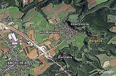
- Picture 1: Google Earth
Last edited: 27 Dec 2007 Object ID: 427
https://kulturdb.de/en/objekt/427-landscheid-burgreste
Nearby
The nearest objects
 100 m
Spur Castles
Burgeck
No picture
110 m
Mills
Burger Mühle im Salmtal
No picture
280 m
Mills
Ranzenmühle an der Salm
No picture
480 m
Mills
Heisterer- oder Herbstmühle
No picture
540 m
Field Names
Krummenstück
No picture
600 m
Field Names
Hielenpesch
No picture
680 m
Catering, Inns and Hotels
Hotel Viktoria
No picture
940 m
Find Sites