Field Names · Undated
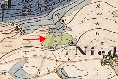
Paradiesje


© GeoBasis-DE / LVermGeoRP, dl-de/by-2-0
There is no picture of this object yet. Do you have a photo that you would like to make available to the Kulturdatenbank? Submit a picture
Description
This description is only available in German.
Translate with Google opens this page in Google Translate (external service)
Südwestliche Hanglage im Bereich "Himmelreich". Eingefriedete Wiesen und Äcker. [1]
Classification
- Subject area
- History
- Category
- Field Names
- Date
- Undatiert
- Period
- Undated
Location
- District
- Vulkaneifel
- Town
- Gerolstein
- Locality / location
- Büscheich
- Field name
- Im Himmelreich
- Coordinates
- WGS 84: 50.193820, 6.658040 (Position: presumed) WGS 84: 50° 11′ 37.8″ N, 6° 39′ 28.9″ E UTM 32 (ETRS89): E 332843 · N 5562806
Sources
Data sources
- [1] Oswald Weber, Gerolstein-Büscheich, 2017.
On the internet
Last edited: 4 May 2017 Object ID: 42963
https://kulturdb.de/en/objekt/42963-gerolstein-paradiesje
Nearby
The nearest objects
Field Names
Im vordersten Berg
 140 m
Field Names
Im runden Wieschen
Field Names
Im Himmelreich
Field Names
Auf Mannhäuserflur
Field Names
Ob Seckert
Field Names
Im Erlenborn
Field Names
De Koul
Field Names