Wayside Shrines and Stations of the Cross · 20th Century
Ehemaliges Grabkreuz


Classification
- Subject area
- Architectural and Art Monuments
- Category
- Religious Buildings
- Object type
- Wayside Shrines and Stations of the Cross
- Date
- 1976
- Period
- 20th Century
Location
- District
- Vulkaneifel
- Collective municipality
- Gerolstein
- Municipality
- Birresborn
- Field name
- In Felst
- Coordinates
- WGS 84: 50.183843, 6.628566 (Position: exact) WGS 84: 50° 11′ 01.8″ N, 6° 37′ 42.8″ E UTM 32 (ETRS89): E 330704 · N 5561763
Sources
Data sources
On the internet
Picture credits
Last edited: 8 Jul 2017 Object ID: 43990
https://kulturdb.de/en/objekt/43990-birresborn-ehemaliges-grabkreuz
Nearby
The nearest objects
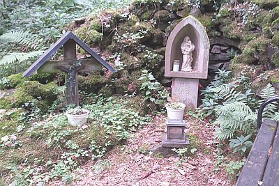 less than 10 m
Marian Grottoes
Mariengrotte mit Bildstock
No picture
110 m
Extraction and Processing of Raw Materials
Mühlsteinbruch am Kalem
No picture
200 m
Field Names
Aufm Wittumhofen
No picture
260 m
Marian Grottoes
Mariengrotte im Winkler Weg
No picture
320 m
Extraction and Processing of Raw Materials
Mühlsteinbruch am Kalem
No picture
360 m
Extraction and Processing of Raw Materials
Mühlsteinbruch am Kalem
No picture
370 m
Surveying
Trigonometrisches Signal
No picture
420 m
Lime Kilns