Burial Mounds · Undated
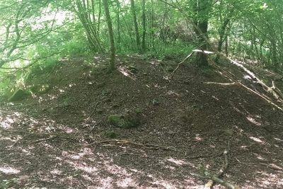
Grabhügel
- Listed monument


© GeoBasis-DE / LVermGeoRP, dl-de/by-2-0
There is no picture of this object yet. Do you have a photo that you would like to make available to the Kulturdatenbank? Submit a picture
Classification
- Subject area
- Archaeological Monuments
- Category
- Burials
- Object type
- Burial Mounds
- Date
- Undatiert
- Period
- Undated
Location
- District
- Eifelkreis Bitburg-Prüm
- Collective municipality
- Speicher
- Municipality
- Spangdahlem
- Field name
- Saalholz
- Coordinates
- WGS 84: 50.003173, 6.710742 (Position: exact) WGS 84: 50° 00′ 11.4″ N, 6° 42′ 38.7″ E UTM 32 (ETRS89): E 335954 · N 5541495
Sources
Data sources
- [1] Geodaten von OpenStreetMap die freie Weltkarte. http://www.openstreetmap.org CC-BY-SA, 2019.
On the internet
Last edited: 21 Sep 2019 Object ID: 48388
https://kulturdb.de/en/objekt/48388-spangdahlem-grabhuegel
Nearby
The nearest objects
No picture
370 m
Wayside Shrines and Stations of the Cross
Wegekreuz
No picture
430 m
Burial Mounds
Grabhügel
No picture
430 m
Fords
Furt durch den Kailbach
No picture
430 m
Mills
Brandenmühle
 500 m
Castles
Ehemalige Brandenburg
No picture
510 m
Road Transport
Mittelalterliche Fahrstraße
 590 m
Firs
Dreiarmige Fichte (Rottanne)
No picture
600 m
Wayside Shrines and Stations of the Cross