Surveying · Neoclassicism
Ehem. Bergbaum als Signalbaum auf dem Junkerberg


© GeoBasis-DE / LVermGeoRP, dl-de/by-2-0
There is no picture of this object yet. Do you have a photo that you would like to make available to the Kulturdatenbank? Submit a picture
Classification
- Subject area
- Natural Features
- Category
- Markers and Monuments
- Object type
- Surveying
- Date
- 1810
- Period
- Neoclassicism
Location
- District
- Vulkaneifel
- Collective municipality
- Daun
- Municipality
- Ellscheid
- Field name
- Aufm Berg Junkerland
- Coordinates
- WGS 84: 50.149580, 6.925880 (Position: exact) WGS 84: 50° 08′ 58.5″ N, 6° 55′ 33.2″ E UTM 32 (ETRS89): E 351821 · N 5557321
Sources
Data sources
- [1] Kartenaufnahme der Rheinlande - durch Tranchot und von Müffling. Blattnummer:168, Jahrgang:1810/11, Blattname: Gillenfeld, Aufnahme: französische Ing. Geographen.
On the internet
Last edited: 16 Sep 2020 Object ID: 49950
https://kulturdb.de/en/objekt/49950-ellscheid-ehem-bergbaum-als-signalbaum-auf-dem-junkerberg
Nearby
The nearest objects
No picture
90 m
Field Names
Aufm Berg Junkerland
No picture
290 m
Viewpoints
Maarblick
No picture
330 m
Field Names
Ober Queckborn
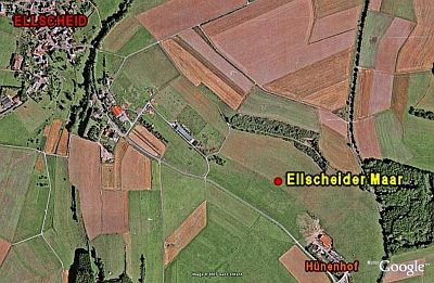 510 m
Dry Maars
Ellscheider Maar
No picture
530 m
Field Names
Auf Queckborn
No picture
580 m
Field Names
Am Queckborn
No picture
590 m
Field Names
Im Strotpesch
No picture
820 m
Burial Mounds