Settlements · Celtic / Roman Period
Römische Baureste

Classification
- Subject area
- Archaeological Monuments
- Category
- Settlements
- Object type
- Settlements
- Date
- Circa 500 vor Chr. bis circa 500 nach Chr.
- Period
- Celtic / Roman Period
Location
- District
- Trier-Saarburg
- Collective municipality
- Ruwer
- Municipality
- Mertesdorf
- Locality / location
- Deponie
- Field name
- Jungenwald
- Coordinates
- WGS 84: 49.773900, 6.755080 (Position: exact) WGS 84: 49° 46′ 26.0″ N, 6° 45′ 18.3″ E UTM 32 (ETRS89): E 338367 · N 5515911
Sources
Data sources
- [1] Grebe, Heinrich, 1891: "Geologische Spezialkarte von Preussen und den Thüringischen Staaten" und Nachfolgewerke; [Neue Nr.6206]; Pfalzel; Gradabteilung 80, Blatt 15. Kraatz, Berlin, DOI 10.23689/fidgeo-3842.
On the internet
Picture credits
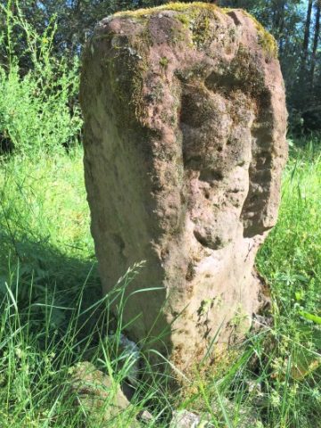
- Picture 1: © Lothar Monshausen, Fotostream http://www.flickr.com/photos/lomo56/tags/meteorite/
Last edited: 4 Jul 2021 Object ID: 50665
https://kulturdb.de/en/objekt/50665-mertesdorf-roemische-baureste
Nearby
The nearest objects
No picture
320 m
Viewpoints
Aussichtspunkt Kahlenberg
No picture
480 m
Field Names
Ober der Pantenwies Galdberg unterm Galdberg
No picture
620 m
Field Names
Am Galdberg
No picture
660 m
Field Names
Unterm Galdberg
No picture
740 m
Field Names
In den Galdgraben
 810 m
Execution Sites
Richtstein der Gerichtsbarkeit Fell
No picture
820 m
Field Names
Reiserheck
No picture
870 m
Field Names