Mineral Springs · 20th Century
Mineralquelle Duppacher Drees
Naturdenkmal
- Listed monument


Description
This description is only available in German.
Translate with Google opens this page in Google Translate (external service)
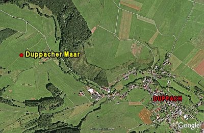
Die Quelle liegt im gleichnamigen Duppacher Maar. Da diese Quelle etwas mehr Natriumchlorid (Kochsalz) im Wasser gelöst hat, schmeckt sie auch ein bisschen anders. Und hält man bei Windstille eine brennende Kerze in die tiefste Stelle der Brunnenfassung so erlischt diese, weil sich das schwere CO2-Gas, das mit dem Wasser gefördert wird, hier sammelt.
Classification
- Subject area
- Natural Features
- Category
- Springs
- Object type
- Mineral Springs
- Date
- 04.03.1961 [Unterschutzstellung]
- Period
- 20th Century
Location
- District
- Vulkaneifel
- Collective municipality
- Gerolstein
- Municipality
- Duppach
- Locality / location
- Forsthaus Duppach
- Field name
- Beim Dreis
- Coordinates
- WGS 84: 50.263841, 6.551401 (Position: exact) WGS 84: 50° 15′ 49.8″ N, 6° 33′ 05.0″ E UTM 32 (ETRS89): E 325488 · N 5570835
Sources
Data sources
- Tourist-Information Gerolsteiner Land, Kyllweg 1 · 54568 Gerolstein, Tel. (06591)13180 · Fax (06591) 13183; touristinfo@gerolsteiner-land.de www.gerolsteiner-land.de
On the internet
vulkaneifel-european-geopark.de/twg/pdfs/wasser-flyer-d.pdf
Picture credits
Last edited: 20 Oct 2010 Object ID: 5095
https://kulturdb.de/en/objekt/5095-duppach-mineralquelle-duppacher-drees
Nearby
The nearest objects
Dry Maars
Vulkan Duppacher Maar
 320 m
Dry Maars
Duppacher Maar
Extraction and Processing of Raw Materials
Ehemaliger Steinbruch
Field Names
Auf Buchholz
Extraction and Processing of Raw Materials
Mühlsteinbruch In der Ley
Field Names
Hinter Buchholz
Wayside Shrines and Stations of the Cross
Wegekreuz
Wayside Shrines and Stations of the Cross