Field Names · Undated
Im Reiserbüsch


© GeoBasis-DE / LVermGeoRP, dl-de/by-2-0
There is no picture of this object yet. Do you have a photo that you would like to make available to the Kulturdatenbank? Submit a picture
Description
This description is only available in German.
Translate with Google opens this page in Google Translate (external service)
Reis — Bedeutung: Waldteil, in dem es gestattet ist, Reishollz für die Bedürfnisse der Landwirtschaft zu holen; dann kollektiv: Wald, der überwiegend aus Buschwerk besteht, aus dem man nichts anderes als Reisig holen kann. [1]
Classification
- Subject area
- History
- Category
- Field Names
- Date
- Undatiert
- Period
- Undated
Location
- District
- Bernkastel-Wittlich
- Collective municipality
- Bernkastel-Kues
- Municipality
- Piesport
- Locality / location
- Niederemmel
- Field name
- Im Reiserbüsch
- Coordinates
- WGS 84: 49.861998, 6.928829 (Position: exact) WGS 84: 49° 51′ 43.2″ N, 6° 55′ 43.8″ E UTM 32 (ETRS89): E 351146 · N 5525344
Sources
Data sources
- [1] Dittmaier, Heinrich: Rheinische Flurnamen. Ludwig Röhrscheid Verlag, Bonn, 1963.
On the internet
Last edited: 5 Feb 2023 Object ID: 52268
https://kulturdb.de/en/objekt/52268-piesport-im-reiserbuesch
Nearby
The nearest objects
 180 m
Extraction and Processing of Raw Materials
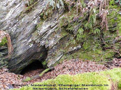
Ehemaliger Steinbruch Im Reiserbüsch
Ferries
Ehemalige Kahnfähre
Field Names
Vor dem Reiserbüsch
Viewpoints
Blick auf die Moselloreley
Field Names
Im Kappesbungert
Vineyard Sites
Olk
Field Names
Aufm Schafhausroth
Field Names