Extraction and Processing of Raw Materials · Renaissance
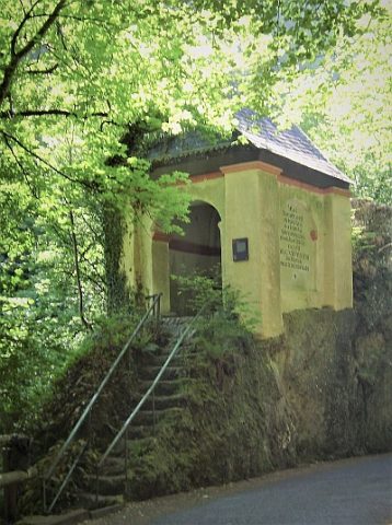
Stolleneingang


© GeoBasis-DE / LVermGeoRP, dl-de/by-2-0
There is no picture of this object yet. Do you have a photo that you would like to make available to the Kulturdatenbank? Submit a picture
Description
This description is only available in German.
Translate with Google opens this page in Google Translate (external service)
Alter Stolleneingang im Gebiet der früheren Bernkasteler Erzbergwerke. Vom 16. bis 19. Jahrhundert wurde in rund 40 Gruben um Bernkastel herum Erz abgebaut. [1]
Classification
- Subject area
- Architectural and Art Monuments
- Category
- Economy, Trade and Transport
- Object type
- Extraction and Processing of Raw Materials
- Date
- 16. Jahrhundert
- Period
- Renaissance
Location
- District
- Bernkastel-Wittlich
- Town
- Bernkastel-Kues
- Locality / location
- Bernkastel
- Field name
- Aufm Plunert im Jungenwald
- Coordinates
- WGS 84: 49.908557, 7.079479 (Position: exact) WGS 84: 49° 54′ 30.8″ N, 7° 04′ 46.1″ E UTM 32 (ETRS89): E 362105 · N 5530232
Sources
Data sources
- [1] Erich Wilbert, Bernkastel-Kues, 2023.
- [2] Topographische Karte 1:25000 von 1970 https://geo4.service24.rlp.de/client/lf/lawa/
On the internet
Last edited: 17 Aug 2023 Object ID: 52745
https://kulturdb.de/en/objekt/52745-bernkastel-kues-stolleneingang
Nearby
The nearest objects
Mills
Ehemalige Räths-Mühle am Tiefenbach
 90 m
Wayside Shrines and Stations of the Cross
Deigen-Kreuz
Viewpoints
Aussichtspunkt
Vineyard Sites
Margaretenberg
 300 m
Chapels
Sogenannte Tinkelkapelle
300 m
Temples, Sanctuaries
Sogenannte Tinkelkapelle - Germanische Kultstätte
Field Names
Die Abendheld
Vineyard Sites