Wayside Shrines and Stations of the Cross · Baroque / Rococo
Schwarzes Kreuz
- Listed monument


Description
This description is only available in German.
Translate with Google opens this page in Google Translate (external service)
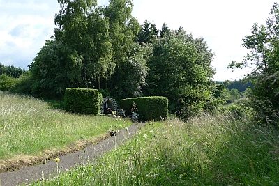
Kreuz an der Landesstraße 27. Auf Höhenpunkt 611,9 Meter über Normal-Null. Südlich der Ortslage an der Straße nach Neroth. Sogenanntes Schwarzes Kreuz, Balkenkreuz, Basaltlava, bezeichnet 1728. [1]
Classification
- Subject area
- Architectural and Art Monuments
- Category
- Religious Buildings
- Object type
- Wayside Shrines and Stations of the Cross
- Date
- 1728
- Period
- Baroque / Rococo
Location
- District
- Vulkaneifel
- Collective municipality
- Daun
- Municipality
- Kirchweiler
- Field name
- Ober Roth
- Coordinates
- WGS 84: 50.214121, 6.740734 (Position: exact) WGS 84: 50° 12′ 50.8″ N, 6° 44′ 26.6″ E UTM 32 (ETRS89): E 338813 · N 5564881
Sources
Data sources
- [1] Denkmalliste der Generaldirektion Kulturelles Erbe, Rheinland-Pfalz; 2009.
On the internet
Picture credits
Last edited: 15 Jul 2009 Object ID: 5559
https://kulturdb.de/en/objekt/5559-kirchweiler-schwarzes-kreuz
Nearby
The nearest objects
Field Names
Ober Roth
Field Names
Ober Roth
 270 m
Pilgrimage Sites
Muttergottes-Ehrenmal
Extraction and Processing of Raw Materials
Ehemaliger Steinbruch
Field Names
Röderseifen
Field Names
Beim Weiherborn
Deserted Settlements
Wüstung Oberroth
Field Names